FIELD GUIDE · CHAPTER 28 · REGION IEST. 2026
Nevada
The Silver State
NV · 39°20′ N · 116°38′ W · 260 SITES SURVEYED
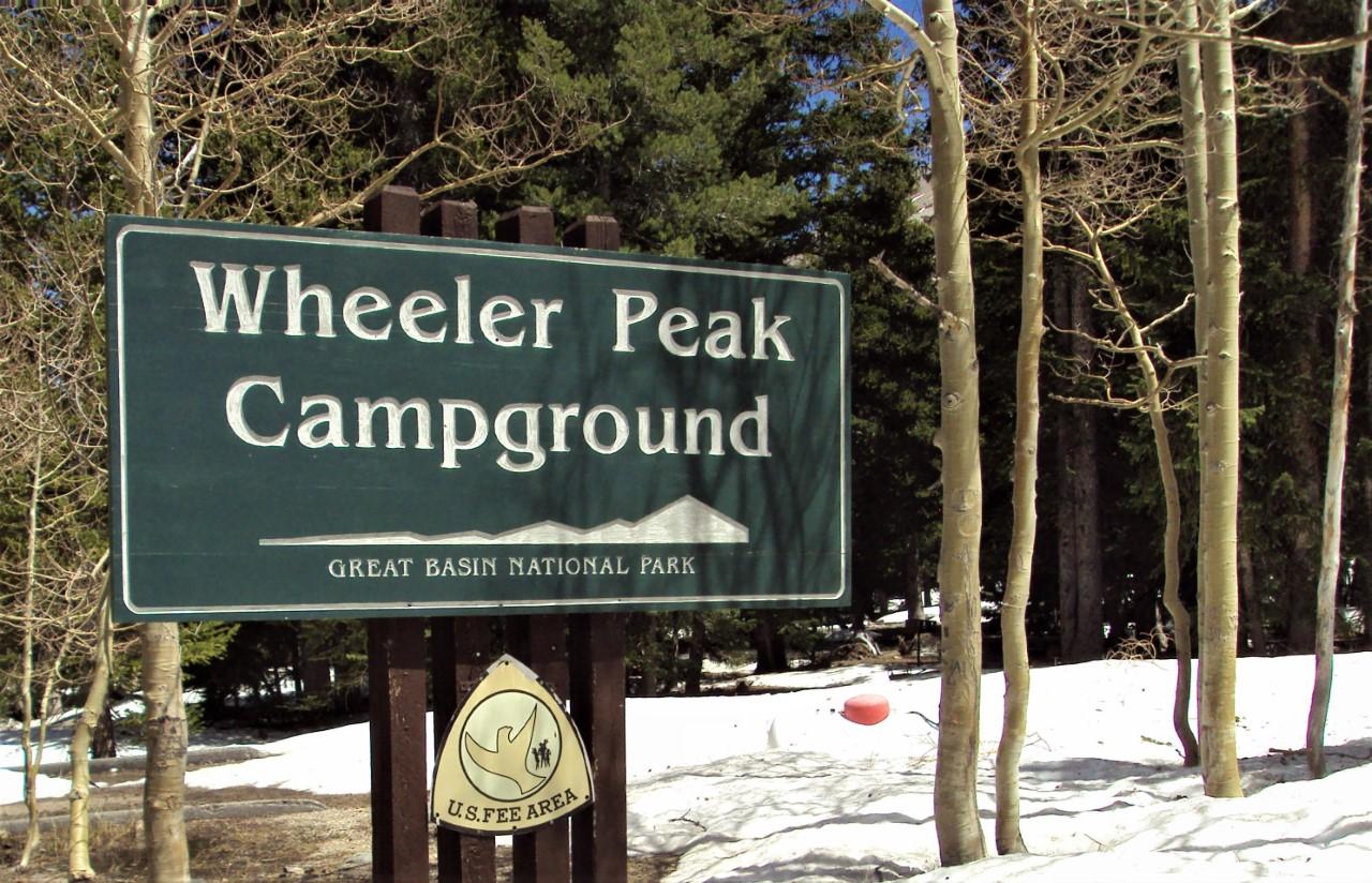
WHEELER PEAK CAMPGROUND · PLATE A-281
§ 01 — Opening Plate
A letter from the field
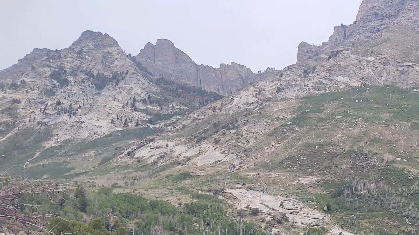
Nevada is 87 percent federal land — the highest share of any state in the Lower 48 — and 80 percent sagebrush steppe and basin-and-range desert, the driest landscape in the United States. Great Basin National Park east of Ely holds 5,000-year-old bristlecone pines on the Wheeler Peak rock glacier, among the oldest non-clonal living things on Earth. Lake Mead, when full, is the largest reservoir in the United States by volume — and Hoover Dam still anchors its southwest shore. The Ruby Mountains rise to 11,387 feet east of Elko, the alpine surprise of the Great Basin, with the Ruby Crest Trail traversing 35 miles of cirque lakes. Mount Charleston at 11,918 feet is the alpine escape an hour from Las Vegas. Lake Tahoe's east shore, half-Nevada, holds the clearest water of any lake its size in North America. The state has 314 named mountain ranges, more than any other, separated by sagebrush valleys that go on for sixty miles between summits.
§ 02 — The Plates
Top 10 sites, filed
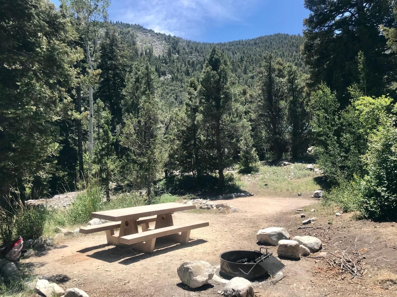
Wheeler Peak Campground
Great Basin National Park's highest campground sits at 9,950 feet on the north slope of 13,065-foot Wheeler Peak — the second-highest peak in Nevada and the highest road-accessible campground in the Great Basin. Thirty-seven sites among Engelmann spruce and subalpine fir. The Bristlecone-Glacier Trail (4.6 mi RT) leaves from camp and climbs to the Wheeler Peak rock glacier and the 5,000-year-old bristlecone pine grove — the oldest non-clonal living trees on Earth. First-come, first-served late May through late October depending on snow. International Dark Sky designation means the Milky Way is unmistakable overhead.
Upper Lehman Creek Campground
Great Basin National Park's mid-elevation campground at 7,752 feet along Lehman Creek — twenty-two sites tucked into ponderosa pine and white fir on a fast-running mountain creek. The Lehman Creek Trail connects all four park campgrounds (Lower Lehman, Upper Lehman, Wheeler Peak) via 6.8 miles of climbing creek-side path. Reservations on Recreation.gov mid-May through late September; first-come the rest of the year. Lehman Caves are eight miles down the road from the visitor center, with daily guided tours by reservation.
Thomas Canyon Campground
Humboldt-Toiyabe National Forest's Lamoille Canyon flagship sits at 7,300 feet in the Ruby Mountains — the alpine range that catches more snow than anywhere else in the Great Basin. Forty sites under quaking aspen along Thomas Canyon Creek, with a 4-mile spur trail climbing to Lamoille Lake (9,742 ft) and the Ruby Crest Trail. Lamoille Canyon Road (NF-660) is twelve miles of paved switchbacks from Lamoille and gains 3,300 feet — closed in winter. Reservable on Recreation.gov mid-May through mid-October; black bears in the canyon.
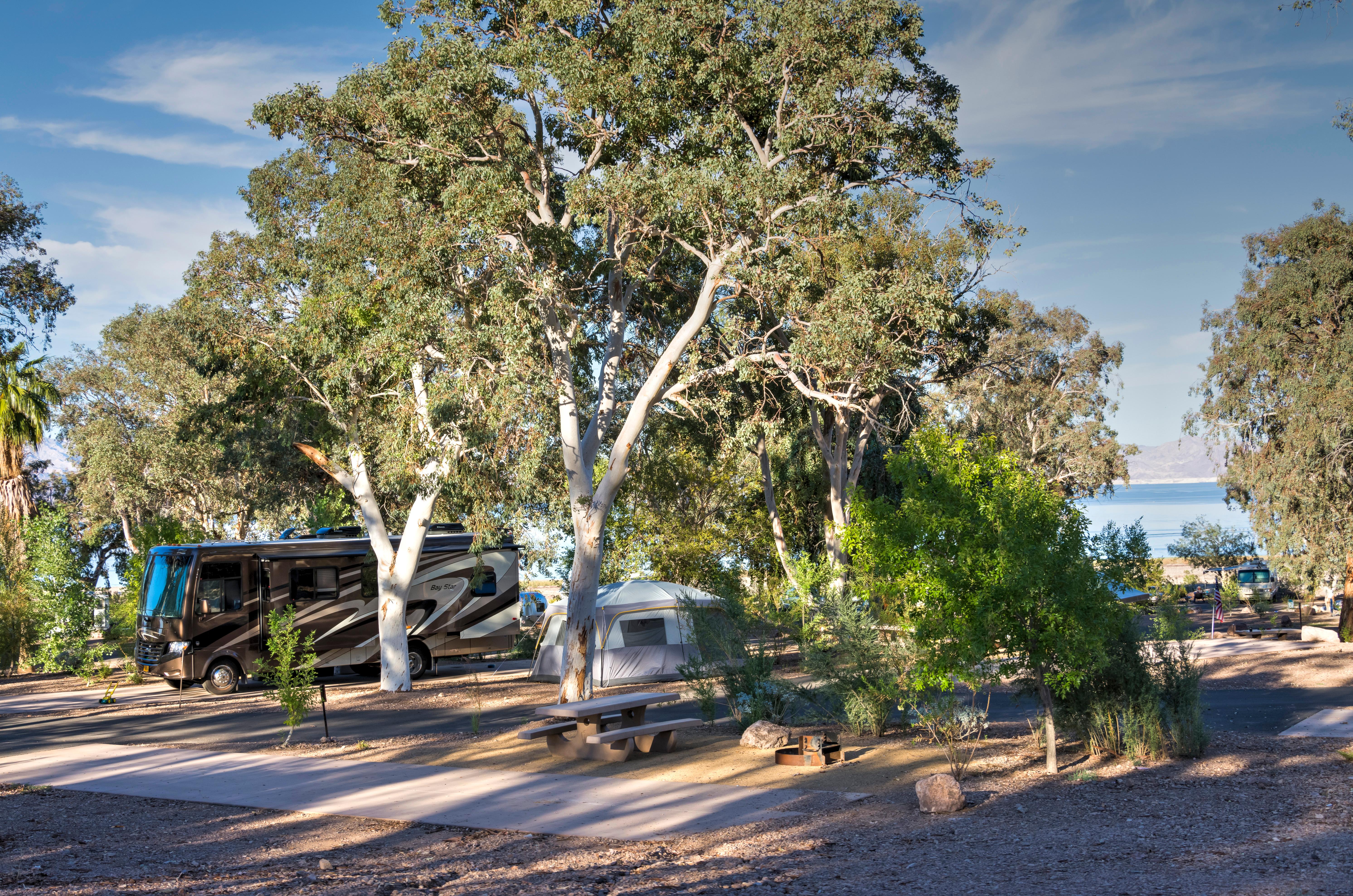
Boulder Beach Campground
Lake Mead National Recreation Area's main campground sits at 1,200 feet on the southwest shore of Lake Mead — when full, the largest reservoir by volume in the United States. One hundred fifty-four sites spread across desert flats above the swim beach, with limited shade (creosote and palo verde, not trees) and a dump station on site. The lake's bathtub ring marks 175 feet of drawdown since the 2000-era high — still a hard reality of southwest hydrology. Hoover Dam sits seven miles south. Reservable on Recreation.gov; open year-round but brutal in July and August (110°F-plus).
- 05Nevada Beach CampgroundHumboldt-Toiyabe National Forest's Lake Tahoe east-shore campground sits at 6,260 feet on a half-mile…→
- 06Fletcher View CampgroundHumboldt-Toiyabe's Spring Mountains National Recreation Area campground sits at 7,000 feet in Kyle Canyon,…→
- 07Cottonwood Cove CampgroundLake Mead NRA's quietest developed campground sits at 660 feet on Lake Mohave —…→
- 08Angel Lake CampgroundHumboldt-Toiyabe's East Humboldt Range campground sits at 8,400 feet on the shore of Angel…→
- 09Echo Bay CampgroundLake Mead NRA's north-shore campground sits at 1,500 feet on the Overton Arm —…→
- 10Baker Creek CampgroundGreat Basin National Park's lower-elevation campground at 7,530 feet on Baker Creek — thirty-eight…→
§ 03 — Field Data
The working page
Best Time
Great Basin and the Ruby Mountains open and peak. Wheeler Peak Campground is the highest road-accessible camp in the state at 9,950 feet — fifteen degrees cooler than the basins below, with wildflower meadows in late July. The Ruby Crest Trail dries out by late June. Mount Charleston is the high-elevation Vegas escape — Kyle Canyon at 7,000 feet runs in the 70s while Vegas hits 110. Lake Mead summers are brutal (110°F-plus) — most travelers cluster around the swim beach at dawn and dusk. Wildfire smoke from California fires routinely hazes northern Nevada from July through October. Reservations for Thomas Canyon, Nevada Beach, and Great Basin's reservable sites fill on six-month windows.
Reservations
Permits & Signal
Camping Etiquette
Yes, across virtually all of Nevada's BLM and USFS land — the highest share of dispersed-camping-friendly public land in the Lower 48. BLM allows up to 14 days in a 28-day window in any single area.…
§ 04 — Almanac
Four seasons, four readings
Spring
Mar–May
Lake Mead and the Mojave Desert hit their best window — March and April put the southern reservoirs in the 70s and 80s, the wildflower bloom across the Mojave is at peak, and the campgrounds aren't yet stifling. Great Basin and the Ruby Mountains stay snowbound; Wheeler Peak Campground typically doesn't open until late May or early June, and Lamoille Canyon Road to Thomas Canyon stays gated into May. Mount Charleston above 7,000 feet keeps snow through April. The Black Rock Desert dries out from playa mud and reopens to vehicles in April; Pyramid Lake's spring cutthroat fishery peaks now. Wind is the seasonal hazard — 30-50 mph afternoon gusts across the open basins are routine.
Summer
Jun–Aug
Great Basin and the Ruby Mountains open and peak. Wheeler Peak Campground is the highest road-accessible camp in the state at 9,950 feet — fifteen degrees cooler than the basins below, with wildflower meadows in late July. The Ruby Crest Trail dries out by late June. Mount Charleston is the high-elevation Vegas escape — Kyle Canyon at 7,000 feet runs in the 70s while Vegas hits 110. Lake Mead summers are brutal (110°F-plus) — most travelers cluster around the swim beach at dawn and dusk. Wildfire smoke from California fires routinely hazes northern Nevada from July through October. Reservations for Thomas Canyon, Nevada Beach, and Great Basin's reservable sites fill on six-month windows.
Fall
Sep–Nov
Arguably the best month-and-a-half of the year — the aspens turn gold across Lamoille Canyon, Baker Creek, and the East Humboldts in the last week of September through mid-October, and the temperature curve drops back into the comfortable range basin-wide. Great Basin's Astronomy Festival runs the third weekend of September. Wheeler Peak Campground closes by late October; Lamoille Canyon and Angel Lake roads gate with the first heavy snow, typically mid-November. Lake Mead and Lake Mohave return to perfect 70s-and-80s weather. Mount Charleston's aspens turn gold a week behind the Ruby Mountains.
Winter
Dec–Feb
Lake Mead, Lake Mohave, and the Mojave campgrounds run year-round and hit their best off-season — 60s during the day, low 40s at night, no crowds, and the bighorn sheep come down to the canyon walls. Great Basin closes the Wheeler Peak Scenic Drive above the lower campground in winter; Lower Lehman Creek stays open year-round. Mount Charleston turns into a ski destination (Lee Canyon resort) and the road from Vegas climbs into snow within an hour. Lake Tahoe's east shore at Nevada Beach is closed seasonally. Northern Nevada (Elko, Wells) gets serious cold — minus-20s in January are common.
§ 05A — Activity File
Best for Hiking & Backpacking
Nevada's hiking is built on the Great Basin's range-and-basin geography — 314 mountain ranges separated by sagebrush valleys — with the marquee objectives in the Snake Range (Wheeler Peak, Mount Moriah), the Ruby Mountains east of Elko, and the East Humboldts. These four campgrounds anchor the alpine half.
Wheeler Peak Campground
The Bristlecone-Glacier Trail (4.6 mi RT) leaves from camp to the 5,000-year-old bristlecone grove and the Wheeler Peak rock glacier — and the Wheeler Peak Summit Trail (8.6 mi RT, 2,900 ft gain) tops out at 13,065 feet.
Thomas Canyon Campground
The Lamoille Lake spur (4 mi RT) climbs to a cirque tarn at 9,742 feet, and the Ruby Crest National Recreation Trail runs 35 miles south from Lamoille trailhead across the spine of the Ruby Mountains.
Angel Lake Campground
The Greys Lake Trail (3 mi RT) and Smith Lake Trail (5 mi RT) leave from the lake shore for higher cirques in the East Humboldts, with ice often lingering on Greys into July.
Upper Lehman Creek Campground
The Lehman Creek Trail (6.8 mi between Lower Lehman and Wheeler Peak campgrounds) is the spine route through Great Basin's east-slope forest, and the Alpine Lakes Loop (2.7 mi RT) leaves from Wheeler Peak Campground up the road.
§ 05B — Activity File
Best for RV Camping
Nevada's RV options center on Lake Mead National Recreation Area — paved NPS loops at four lakes with dump stations and reservoir access — and the Spring Mountains NRA west of Vegas. Year-round Lake Mead access at 110°F summers and mild winters is the standout draw.
Boulder Beach Campground
One hundred fifty-four sites at 1,200 feet on Lake Mead with paved loops, dump station, and easy turn-arounds — the standard RV base for the southern Lake Mead and Hoover Dam corridor.
Cottonwood Cove Campground
One hundred forty-five sites at 660 feet on Lake Mohave with the marina, full hookups available at the adjacent concessioner-operated RV park, and the coolest reservoir water in the system below Davis Dam.
Echo Bay Campground
One hundred fifty-three sites plus twenty-five dedicated RV sites at 1,500 feet on the Overton Arm of Lake Mead — paved loops, dump station, and the quietest of the developed Lake Mead bases.
Fletcher View Campground
Twelve sites at 7,000 feet in Kyle Canyon on Mount Charleston — paved loops with rigs up to 35 feet, no hookups, but the only summer-cool RV base inside an hour of Las Vegas.
§ 05C — Activity File
Best for Lake & Reservoir Camping
Nevada's lake camping splits between the desert reservoirs of the Lake Mead system (the largest US reservoir by volume when full, three connected lakes covering 290 miles of shoreline) and the alpine clarity of Lake Tahoe's east shore. These four campgrounds cover both ends.
Boulder Beach Campground
Lake Mead's headliner — main swim beach, the closest base to Hoover Dam, and direct access to 290 miles of reservoir shoreline including the deep canyons of Black Canyon south of the dam.
Echo Bay Campground
Lake Mead's quieter north arm with red Aztec sandstone formations rising from the lake — Valley of Fire State Park's signature rock pinnacles are ten miles up SR-169.
Cottonwood Cove Campground
Lake Mohave's coldest, clearest water — Hoover Dam tailwater keeps the reservoir colder than Mead year-round, with trout fishing and quieter coves carved into the volcanic canyon walls.
Nevada Beach Campground
Lake Tahoe's east shore at 6,260 feet — half-mile natural sand beach, 70-foot Secchi-disc water clarity, and direct walking access to the half-dozen casinos and restaurants at Stateline.
§ 05D — Activity File
Best for Dark Skies & Bristlecone Country
Great Basin National Park holds International Dark Sky designation and one of the darkest measured night skies in the continental United States — Bortle 2 across most of the park, with the Milky Way casting visible shadows on moonless nights. The bristlecone pine groves on Wheeler Peak hold the oldest non-clonal living things on Earth.
Wheeler Peak Campground
At 9,950 feet, the highest road-accessible campground in the Great Basin — perfect base for the bristlecone grove (4.6 mi RT) and Great Basin's annual Astronomy Festival in mid-September.
Upper Lehman Creek Campground
Mid-elevation Great Basin base at 7,752 feet with Lehman Creek running through camp and a star-viewing meadow above the visitor center two miles down the road.
Baker Creek Campground
Great Basin's quietest developed campground at 7,530 feet — six miles of gravel from the highway means the loop is genuinely dark and free of headlight wash.
Thomas Canyon Campground
The Ruby Mountains' Bortle 2-3 skies, far from any city — and the Ruby Crest Trail summit ridges put you above 10,000 feet for unobstructed star-watching with the curve of the Earth's shadow visible at sunset.
§ 07 — Q & A
Frequently asked
It depends on the region. The Lake Mead and Mojave Desert campgrounds (Boulder Beach, Echo Bay, Cottonwood Cove, Valley of Fire) are at their best October through April — summer pushes past 110°F and campgrounds bake. Great Basin and the Ruby Mountains run mid-June through September, with wildflower peak in late July and aspen color in late September. Mount Charleston is a year-round escape from Vegas — alpine camping in summer, snow play and skiing in winter. Lake Tahoe's Nevada side peaks July and August. The shoulder months of May and October work for most of the state.
§ 08 — Adjacent Sheets