FIELD GUIDE · CHAPTER 03 · REGION IIEST. 2026
Arizona
The Grand Canyon State
AZ · 34°16′ N · 111°40′ W · 642 SITES SURVEYED
MATHER CAMPGROUND · PLATE A-031
§ 01 — Opening Plate
A letter from the field
Arizona spans more than 12,000 feet of vertical relief between the Colorado River at 1,200 feet in the western Sonoran Desert and Humphreys Peak at 12,633 feet north of Flagstaff, and that range packs in more national parks and monuments per square mile than any state outside Utah. The Grand Canyon exposes 1.8 billion years of layered stratigraphy along the South and North Rims. Sedona's Schnebly Hill sandstone glows red beneath Oak Creek's sycamores. Saguaro National Park protects the densest stands of the signature 40-foot cactus on the Sonoran Desert floor. The Mogollon Rim climbs 2,000 feet in a single escarpment from desert to ponderosa pine, and the southeastern sky islands rise from grassland into spruce-fir forest above 9,000 feet. Flagstaff became the world's first International Dark Sky City in 2001. The North American monsoon delivers violent July–September afternoon thunderstorms that flood slot canyons and ground hikers off ridgelines — Arizona's defining summer hazard.
§ 02 — The Plates
Top 10 sites, filed
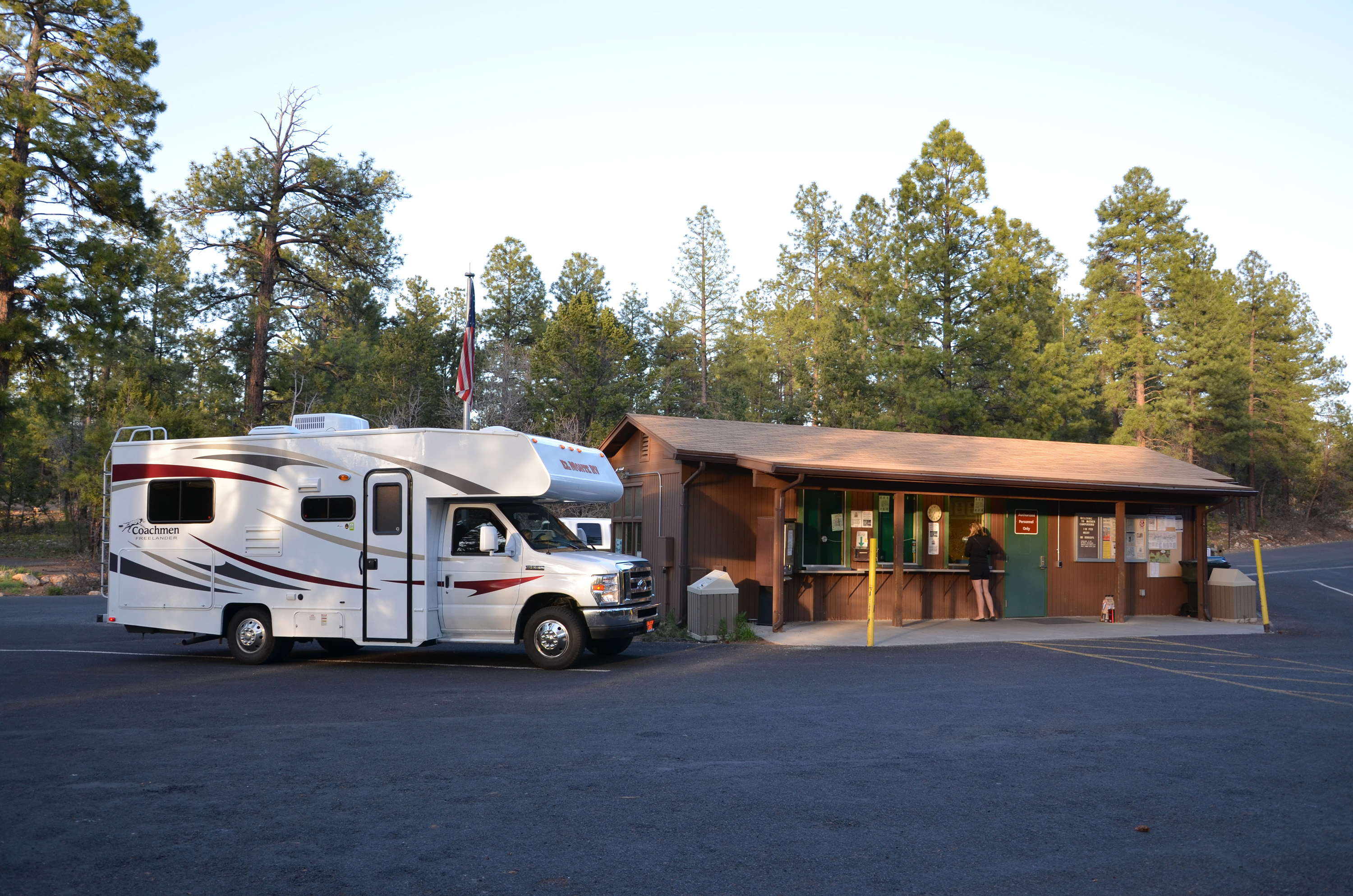
Mather Campground
Grand Canyon's South Rim flagship sits at 6,800 feet under ponderosa pine, 327 sites a half-mile walk from Mather Point and the Rim Trail. Reservations on Recreation.gov roll six months out and release on the 15th at 7 AM Mountain — spring and fall weekends sell out within minutes. The free park shuttle from camp reaches the Bright Angel and South Kaibab trailheads. Grand Canyon NP was designated an International Dark Sky Park in 2019, and the smell of pine resin off warm bark is the South Rim's signature.
North Rim Campground
Mid-May through mid-October only — the gate closes when snow piles on the Kaibab Plateau at 8,200 feet, and the campground sits in quaking aspen and ponderosa pine 1,000 feet higher and 220 driving miles from the South Rim. Or 21 trail miles via the North and South Kaibab through the inner canyon. The North Kaibab trailhead is 1.5 miles from camp. 90 sites on Recreation.gov, cooler nights in the 40s, far fewer visitors than the South Rim — the canyon's quieter half.
Cave Springs Campground
Oak Creek Canyon, 12 miles north of Sedona on US-89A in the Coconino NF — 82 sites strung along Oak Creek beneath Arizona sycamore and Arizona cypress, with red-rock walls rising 1,000 feet directly overhead. Slide Rock State Park's natural sandstone water slides are four miles south. Recreation.gov reservations open six months in advance and book fast for May through October. Potable water on-site, no hookups, and the white noise of Oak Creek running beside the loops drowns out US-89A entirely once you're inside the campground.
Desert View Campground
Twenty-five miles east of the main South Rim village near Mary Colter's 1932 Desert View Watchtower, 50 sites at 7,400 feet open mid-April through mid-October. NPS shifted Desert View to reservation-required on Recreation.gov in recent seasons — no more first-come, first-served. It's the South Rim's quietest developed campground and the closest park camp to the Colorado River confluence with the Little Colorado, and the most logical overnight if you're entering through the East Entrance off US-89 from Cameron and the Navajo Nation.
- 05Rose Canyon Lake CampgroundThe Catalina Highway climbs from saguaro at 2,500 feet to ponderosa pine at 7,000…→
- 06Bonito CampgroundCoconino NF, 7,000 feet at the base of Sunset Crater — a 1,000-foot cinder…→
- 07Bonita Canyon CampgroundChiricahua NM in southeastern Arizona, 25 sites at 5,400 feet in the Wonderland of…→
- 08Twin Peaks CampgroundOrgan Pipe Cactus NM straddles the Mexican border south of Ajo at 1,600 feet,…→
- 09Lockett Meadow CampgroundInside the Inner Basin of the San Francisco Peaks above Flagstaff, a glacial cirque…→
- 10Big Lake Recreation AreaApache-Sitgreaves NF in the White Mountains at 9,000 feet — 84 sites split across…→
§ 03 — Field Data
The working page
Best Time
The state splits in half. North Rim opens around May 15. Sky islands and high country — Mt. Lemmon, the White Mountains, the San Francisco Peaks — become the relief valve when Tucson hits 105°F and Mt. Lemmon at 9,000 feet sits at 75°F up the same highway. The North American Monsoon arrives early-to-mid July and runs through mid-September: daily afternoon thunderstorms, flash floods in Antelope Canyon and Buckskin Gulch, lightning above 8,000 feet. Grand Canyon corridor hiking compresses to pre-dawn — most rim-to-rim fatalities are mid-day dehydration and heat exhaustion between May and September. Plan for shade and water.
Reservations
Permits & Signal
Camping Etiquette
USFS and Arizona state-park campgrounds welcome leashed dogs throughout most loops and on most trails. National parks are far more restrictive: pets are allowed only in developed campgrounds, on paved roads, and on a small number…
§ 04 — Almanac
Four seasons, four readings
Spring
Mar–May
Peak desert season in the south. Saguaro, Organ Pipe, and the Tucson sky-island foothills run 70s by day and 40s overnight before the heat dome arrives. Picacho Peak's Mexican gold poppy bloom hits mid-March in years following a wet winter — a hillside of orange visible from I-10. Grand Canyon's South Rim runs year-round but spring is shoulder pricing and quieter trails. The North Rim gate stays closed until around May 15 while crews clear Kaibab Plateau snow. Sedona and Oak Creek Canyon hit peak — cottonwoods leafing, swim holes still cold enough to be empty. Wildflower viewing peaks late March through late April.
Summer
Jun–Aug
The state splits in half. North Rim opens around May 15. Sky islands and high country — Mt. Lemmon, the White Mountains, the San Francisco Peaks — become the relief valve when Tucson hits 105°F and Mt. Lemmon at 9,000 feet sits at 75°F up the same highway. The North American Monsoon arrives early-to-mid July and runs through mid-September: daily afternoon thunderstorms, flash floods in Antelope Canyon and Buckskin Gulch, lightning above 8,000 feet. Grand Canyon corridor hiking compresses to pre-dawn — most rim-to-rim fatalities are mid-day dehydration and heat exhaustion between May and September. Plan for shade and water.
Fall
Sep–Nov
The broadest sweet spot in the state. Monsoon humidity fades by mid-September and the sky clears to deep blue. Lockett Meadow aspens inside the San Francisco Peaks Inner Basin peak the last week of September through mid-October — the largest aspen stand in Arizona, gold against dark spruce. The North Rim gate closes by mid-October when Kaibab snow returns. Sedona drops into the 70s by day, 40s by night. The Flagstaff Star Party runs the third week of September — telescopes line Buffalo Park and Lowell Observatory in the world's first International Dark Sky City. Sonoran desert temperatures become walkable again by late October.
Winter
Dec–Feb
The desert flips to peak. Organ Pipe, Tucson sky-island foothills, and Lost Dutchman State Park east of Phoenix run 65–75°F by day and 40s overnight — the country's most reliable mid-winter tent camping. Grand Canyon South Rim stays open year-round; Mather books with snow on the rim and overnights in the 20s. The North Rim is fully closed. The San Francisco Peaks and White Mountains pile 100+ inches; Sunrise Park Resort on the Apache reservation is Arizona's largest ski area. Quartzsite is the January phenomenon — 50,000-plus RVs gather on BLM long-term visitor area land for the rock-and-gem shows.
§ 05A — Activity File
Best for Hiking & Backpacking
The Bright Angel and South Kaibab trails out of Grand Canyon Village form the most-traveled inner-canyon corridor in the country, and the 24-mile rim-to-rim traverse from North to South Kaibab is the iconic American canyon hike. Add Chiricahua's hoodoo loops and Oak Creek's red-rock canyon path, and Arizona delivers a hiking story from saguaro desert to subalpine forest.
Mather Campground
The free park shuttle from camp drops at the Bright Angel and South Kaibab trailheads — the launching points for every inner-canyon hike from a day to the river and back to a full rim-to-rim.
North Rim Campground
The North Kaibab trailhead is 1.5 miles from camp — the start of the 14-mile descent to the Colorado River and the northern half of every rim-to-rim crossing through the inner canyon.
Bonita Canyon Campground
The 7-mile Heart of Rocks Loop and 3.3-mile Echo Canyon trails leave from the canyon road above camp, winding through the rhyolite hoodoos of Chiricahua's Wonderland of Rocks.
Cave Springs Campground
The West Fork of Oak Creek trail — Arizona's most-walked red-rock canyon hike — is roughly two miles south on US-89A, and the AB Young, Cookstove, and Harding Spring trails climb directly off the canyon road.
§ 05B — Activity File
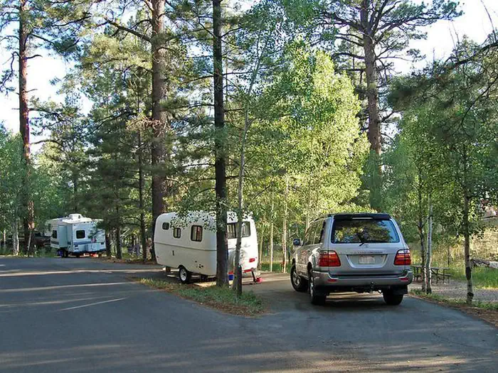
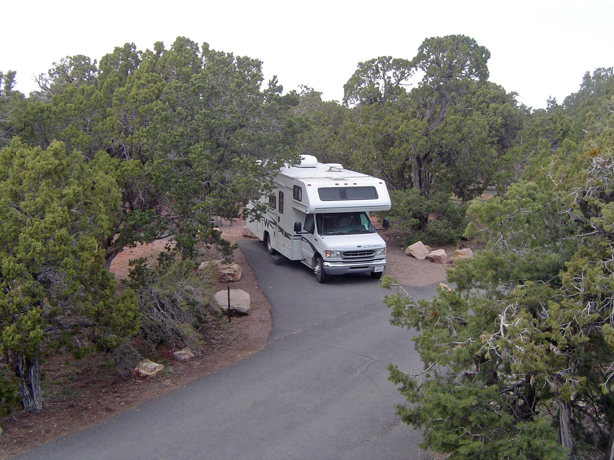
Best for RV Camping
Arizona's RV-friendly campgrounds span more than 7,000 feet of elevation — from Twin Peaks at 1,600 feet on the Sonoran border to Big Lake at 9,000 feet in the White Mountains. Hookups are rare on federal land; most of these sites offer dump stations and pull-through access without electric. Plan power needs accordingly.
Mather Campground
Grand Canyon's year-round South Rim flagship — 327 ponderosa-shaded sites at 6,800 feet with a dump station on-site. No hookups in the main loops, but a separate concession RV park nearby has them.
Twin Peaks Campground
Organ Pipe's 174 sites at 1,600 feet stay open year-round — Arizona's lowest-elevation NPS campground and the best winter RV option in the state, with a dump station and generator-permitted loops.
Big Lake Recreation Area
RV-accessible loops across Cutthroat, Rainbow, Brookchar, and Grayling sub-campgrounds with a shared dump station — no hookups, but the most RV-capable high-elevation option in the state from Memorial Day through mid-October.
Desert View Campground
The South Rim's quieter eastern campground at 7,400 feet — 50 sites, mid-April through mid-October, with pull-throughs and a dump station but no hookups. Reservation-required on Recreation.gov in recent seasons.
§ 05C — Activity File
Best for Stargazing & Dark-Sky Parks
Arizona has more designated International Dark Sky places per capita than nearly any state: Flagstaff became the world's first International Dark Sky City in 2001, and Grand Canyon (2019), Petrified Forest (2018), Walnut Canyon (2019), Saguaro (2022), and Organ Pipe Cactus (2024) all carry NPS dark-sky designation. The Milky Way reads in print here from May through October.
Twin Peaks Campground
Organ Pipe earned International Dark Sky Park status in 2024 — the southernmost and one of the darkest in the system. No city glow for 70 miles in any direction, and winter Milky Way views from the Sonoran floor.
Mather Campground
Grand Canyon NP was designated an International Dark Sky Park in 2019. The North Rim's empty quadrant blocks every direction of city glow, and the annual June Star Party draws telescopes to the South Rim.
Lockett Meadow Campground
The Inner Basin sits at 8,500 feet inside the San Francisco Peaks above Flagstaff — the world's first International Dark Sky City (2001). The cirque walls block town glow, and the aspen canopy frames a clean overhead sky.
§ 05D — Activity File
Best for Sky Islands & High-Elevation Camping
Sky islands are isolated mountain ranges rising from desert basin floor to subalpine forest, with the Madrean Archipelago across southeast Arizona as the type locality. Distinct elevation bands stack saguaro, oak-grassland, pine-oak, and spruce-fir within a single drive, and endemic species — the Mt. Graham red squirrel, the Apache fox squirrel, the Mexican spotted owl — concentrate here.
Rose Canyon Lake Campground
The Catalina Highway climbs through every Madrean life zone — saguaro at 2,500 feet to ponderosa pine at 7,000 — in under an hour. Mt. Lemmon's endemic plants and the southernmost ski area in the U.S. sit above camp.
Bonita Canyon Campground
Chiricahua is the northernmost intact range of the Madrean Archipelago, with Mexican-affinity species like the Apache fox squirrel and elegant trogon. Pine-oak woodland at 5,400 feet sits several life zones above the Sulphur Springs Valley grassland below.
Big Lake Recreation Area
Not a Madrean sky island, but the highest campground in this guide at 9,000 feet — White Mountains alpine on the Mogollon Rim, with stocked trout, mixed-conifer forest, and frost possible into June and from late August.
Lockett Meadow Campground
A glacial cirque at 8,500 feet inside the San Francisco Peaks, ringed by the largest quaking aspen stand in Arizona. The Inner Basin Trail leaves from camp, and peak gold runs late September through mid-October.
§ 07 — Q & A
Frequently asked
Region by region. Grand Canyon South Rim runs year-round with peak conditions in spring and fall; the North Rim is May 15 through mid-October only, gated by Kaibab Plateau snow. Sedona and Oak Creek Canyon hit their stride March through May and again October through November. The Sonoran Desert — Saguaro, Organ Pipe, Lost Dutchman — is October through April, with December and January as the calmest, coolest stretch. Sky islands and the White Mountains belong to summer, June through September, when 9,000-foot pines run 75°F while Tucson cooks at 105°F. The Memorial Day through Labor Day window squeezes the Recreation.gov lottery hardest — South Rim, North Rim, Bonito, Lockett Meadow, and Big Lake all sell out within minutes of the six-month rolling release.
§ 08 — Adjacent Sheets