FIELD GUIDE · CHAPTER 05 · REGION IEST. 2026
California
The Golden State
CA · 37°11′ N · 119°28′ W · 2,018 SITES SURVEYED
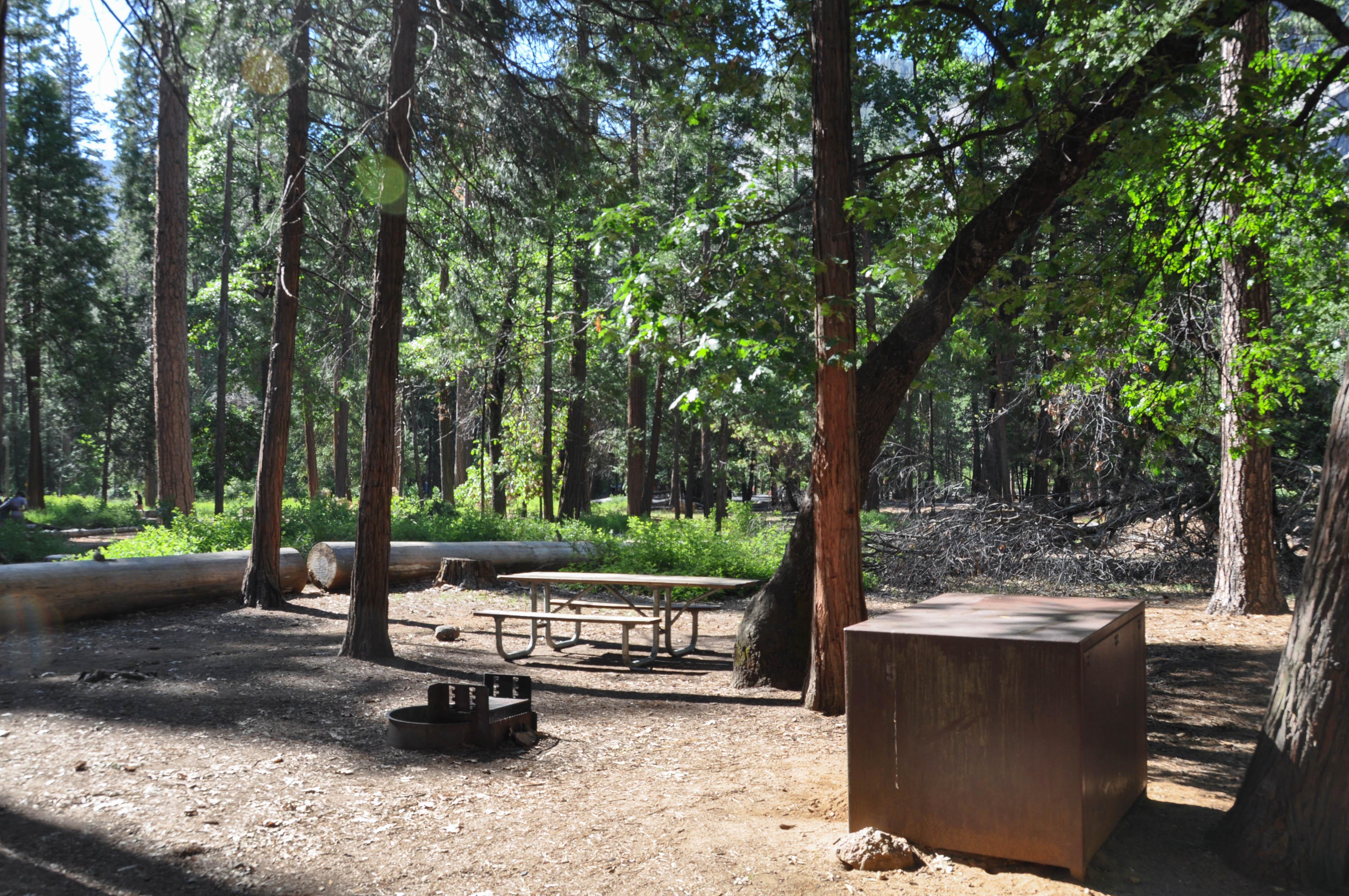
UPPER PINES CAMPGROUND · PLATE A-051
§ 01 — Opening Plate
A letter from the field
California holds nine national parks — more than any other state — and the camping spans an ecosystem range no single state matches. In the Sierra Nevada, Yosemite Valley's 3,000-foot granite walls and Tuolumne Meadows' subalpine flats at 8,600 feet anchor the high country, while Sequoia and Kings Canyon protect the largest trees on earth along the Kaweah River. South, Joshua Tree's monzogranite boulder piles meet the Mojave at 4,000 feet, and Death Valley drops below sea level at Furnace Creek. The coast runs from Big Sur's bluff-edge Los Padres campgrounds above the Pacific to the old-growth redwood groves of Jedediah Smith on the Smith River near the Oregon line. Pinnacles' talus caves shelter California condors in the Gabilan Range, and Lake Tahoe's west shore tucks small USFS camps under ponderosa pine at 6,200 feet. Few states pack snow tundra, redwood fog, and below-sea-level desert within a single weekend's drive.
§ 02 — The Plates
Top 10 sites, filed
Upper Pines Campground
The most-photographed campground in the West sits on the Yosemite Valley floor at 4,000 feet, shaded by ponderosa pine and incense cedar along the Merced River, with 238 sites a short walk from the Mist Trail at Happy Isles. Reservations release on Recreation.gov in rolling blocks on the 15th at 7 AM Pacific and sell out in under a minute for May through September. The Half Dome cables stage from camp via the John Muir Trail. Cottonwood smell on cool morning air; Valley walls catch first light pink.
Tuolumne Meadows Campground
Subalpine flats at 8,600 feet along the Tuolumne River, the largest campground in Yosemite at 304 sites and the resupply hub for John Muir Trail and Pacific Crest Trail thru-hikers. Tioga Road typically opens in mid-June and the campground gates by mid-October — the season is roughly four months. Cathedral Peak, Lembert Dome, and the Sunrise Lakes trailheads sit within two miles of camp. Reservations through Recreation.gov, half the sites first-come. Nights drop into the mid-30s even in July; the meadow grass freezes white before dawn.
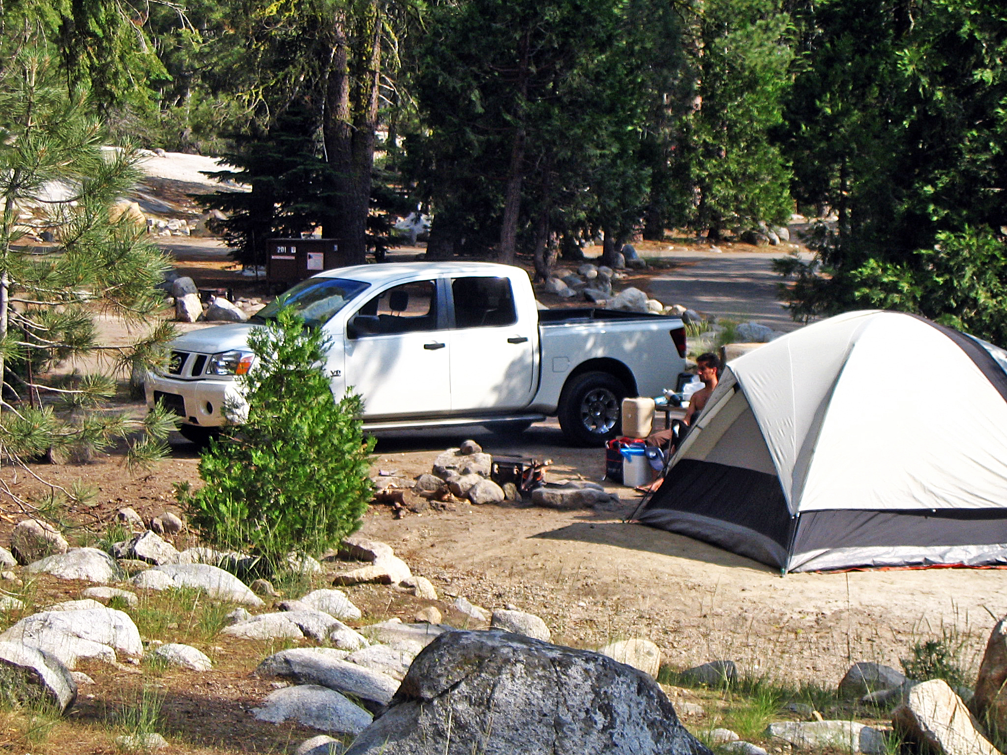
Lodgepole Campground
Walking distance to the General Sherman Tree — the largest tree on earth by volume — and a quarter mile from the Tokopah Falls trailhead at the head of the Marble Fork canyon. The 200-plus sites sit at 6,700 feet along the Kaweah River under lodgepole pine and white fir, in Sequoia black-bear country where canisters are required (free rentals at the Lodgepole visitor center). Reservations on Recreation.gov open six months in advance. The river runs loud all summer; afternoon thunderheads build over the Great Western Divide.

Jumbo Rocks Campground
Sites tucked between house-sized monzogranite boulder piles at 4,400 feet in the high Mojave, with 124 spots and zero shade trees of any size — the rocks themselves are the architecture. Reservation-only year-round on Recreation.gov: October through May books months out, while June through September often has same-day availability when 100°F+ heat empties the park. No water, no hookups; haul everything in from Twentynine Palms. International Dark Sky Park designation: the Milky Way pours over Skull Rock so bright it casts shadows, and the granite glows pink at sunrise.
- 05Furnace Creek CampgroundThe only year-round full-service campground in any California national park, set at -196 feet…→
- 06Kirk Creek CampgroundBluff-edge sites a hundred feet straight above the Pacific on US-1 in the Los…→
- 07Plaskett Creek CampgroundFour miles south of Kirk Creek on US-1, set in a Monterey-cypress and pine…→
- 08Jedediah Smith CampgroundOld-growth coast redwoods on the Smith River — California's largest undammed river — at…→
- 09Kaspian CampgroundA small USFS tent-only camp on Lake Tahoe's west shore along Highway 89 between…→
- 10Pinnacles CampgroundOn the east side of Pinnacles National Park in the Gabilan Range — the…→
§ 03 — Field Data
The working page
Best Time
Sierra and coastal peak; the desert closes down to dangerous. Tioga Pass typically opens by mid-June, finally connecting Yosemite Valley to Tuolumne Meadows, and the Half Dome cables go up Memorial Day weekend. Yosemite's reservation lottery binds hardest now — Upper Pines releases on the 15th of each month at 7 AM Pacific and sells out in under a minute. The park's timed-entry reservation system applies through October on peak days. Wildfire smoke risk begins mid-July and can shut entire forests within hours. Death Valley summer is genuinely lethal: ground temperatures past 180°F, air over 120°F, and Furnace Creek runs almost empty. Coastal fog burns off by mid-morning on the Big Sur bluffs.
Reservations
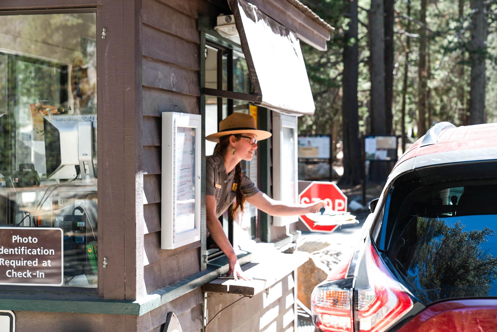
Permits & Signal
Rarely on the beach itself. California's state beaches all require paid reservations through ReserveCalifornia, and there is no legal free camping inside a state beach. The Lost Coast — Sinkyone Wilderness State Park and the BLM…
Camping Etiquette
Mostly yes in campgrounds, mostly no on trails. Leashed dogs are welcome at most state-park campgrounds — D.L. Bliss, Henry Cowell, Big Basin Redwoods, MacKerricher, and Salt Point all allow pets in developed sites. The catch…
§ 04 — Almanac
Four seasons, four readings
Spring
Mar–May
Peak desert season and the only window with the whole state accessible. Joshua Tree, Death Valley, and Anza-Borrego run 70–85°F afternoons, and the Carrizo Plain and Anza-Borrego wildflower blooms — best in years following a wet winter — pull crowds from Los Angeles in March and April. The Sierra stays snowbound above 7,000 feet: Tioga Pass and Glacier Point Road typically don't open until mid-June, and Tuolumne Meadows is unreachable by car. Yosemite Valley waterfalls hit peak runoff — Bridalveil, Vernal, Nevada, and Yosemite Falls thunder in May. Coastal fog (May Gray) builds along Big Sur. Six-month-out reservations for Upper Pines fill the morning the window opens.
Summer
Jun–Aug
Sierra and coastal peak; the desert closes down to dangerous. Tioga Pass typically opens by mid-June, finally connecting Yosemite Valley to Tuolumne Meadows, and the Half Dome cables go up Memorial Day weekend. Yosemite's reservation lottery binds hardest now — Upper Pines releases on the 15th of each month at 7 AM Pacific and sells out in under a minute. The park's timed-entry reservation system applies through October on peak days. Wildfire smoke risk begins mid-July and can shut entire forests within hours. Death Valley summer is genuinely lethal: ground temperatures past 180°F, air over 120°F, and Furnace Creek runs almost empty. Coastal fog burns off by mid-morning on the Big Sur bluffs.
Fall
Sep–Nov
The highest wildfire risk window of the year. September and October bring both active fires and PG&E Public Safety Power Shutoffs (PSPS) that can black out entire counties and close national forests — check pge.com/psps and inciweb.nwcg.gov before any trip. Tuolumne Meadows closes early-to-mid October ahead of the Tioga Pass winter gate, which typically follows in late October or November. Eastern Sierra aspens at Sabrina Lake, June Lake, and Bishop Creek peak from the last week of September through mid-October — one of the West's best fall-color drives. Pinnacles and the Big Sur coast hit prime conditions as the marine layer breaks and summer crowds thin. Desert highs drop into the 70s by November.
Winter
Dec–Feb
Desert season returns. Jumbo Rocks, Furnace Creek, and Anza-Borrego run 60–75°F afternoons with cold clear nights — the best stargazing of the year over Joshua Tree and Death Valley. The Sierra is mostly closed: Tioga Pass is gated roughly November through May, Glacier Point Road shuts the same window, and Tuolumne Meadows, Lodgepole, and most high-country camps are inaccessible. Yosemite Valley plows Upper Pines onto a reduced loop and stays reservable year-round. Generals Highway in Sequoia stays open with chain controls during storms. The coast is shoulder-season — fewer crowds at Kirk Creek and Plaskett Creek but rain-dependent and exposed to big Pacific swells. Gray whales pass close to shore from late December through April.
§ 05A — Activity File
Best for Hiking & Backpacking
California's Sierra Nevada holds the largest concentration of named alpine objectives in the Lower 48 — the 211-mile John Muir Trail, the 14,505-foot summit of Mt. Whitney, and the Tuolumne high country anchor a roof of granite shared by no other state. Pinnacles' talus caves and condor canyons add a non-Sierra hiking story entirely its own.
Tuolumne Meadows Campground
The northern resupply point for John Muir Trail and Pacific Crest Trail thru-hikers, with Cathedral Peak, Lembert Dome, and the Sunrise Lakes trailheads all within two miles of camp at 8,600 feet.
Lodgepole Campground
The Tokopah Falls trail leaves from camp up the Marble Fork canyon, and the Lakes Trail to Heather, Emerald, and Pear Lakes drops in three miles up the Wolverton road — Sequoia's classic alpine loop.
Pinnacles Campground
The High Peaks Loop and the Balconies and Bear Gulch talus caves are the unique pitch — narrow passages where house-sized boulders stack over the creek bed. Bring a headlamp; the east-side trails don't connect to the west.
Upper Pines Campground
The Mist Trail at Happy Isles is a five-minute walk from the campground loops — Vernal Fall, Nevada Fall, the Half Dome cables, and the John Muir Trail south all stage from the same trailhead.
§ 05B — Activity File
Best for RV Camping
California's national-park RV camping spans an elevation range no other state matches — Furnace Creek at 196 feet below sea level to Tuolumne Meadows at 8,600 feet, with afternoon temperatures that can differ by 70°F on the same date. Only a handful of NPS sites accept full-size rigs comfortably, and electric hookups inside park boundaries are vanishingly rare.
Furnace Creek Campground
One of the few NPS campgrounds in California with 30-amp electric hookups, plus a dump station and flush toilets at 196 feet below sea level. Open year-round, but realistically a mid-October through mid-April window — summer ground temperatures past 180°F.
Upper Pines Campground
Accommodates rigs up to 35 feet on the Yosemite Valley floor with a dump station at the Upper Pines exit. No hookups, but the 4,000-foot elevation keeps summer nights cool under ponderosa pine.
Jedediah Smith Campground
A coast-redwoods state-park campground that accepts RVs up to 36 feet with a dump station on-site. No hookups, but pad sites under 300-foot trees are unlike anything in California's desert or Sierra parks.
Lodgepole Campground
Pull-through sites accommodate rigs to 35 feet at 6,700 feet under lodgepole pine, with a dump station near the visitor center. Required bear canisters apply — store food and toiletries out of the rig overnight.
§ 05C — Activity File
Best for Coastal & Big Sur Camping
US-1 between Carmel and San Simeon is the country's most-photographed coastal drive — 90 miles of cliff-edge highway with the Pacific 500 feet below and the Santa Lucias rising 5,000 feet east. California is the only state where you can camp on an open-ocean bluff and inside an old-growth redwood grove in the same trip, with sea-kayak launches at both ends.
Kirk Creek Campground
Every site faces the Pacific from a hundred-foot bluff with no inside loop. Gray whales pass close to shore December through April, visible blowing from camp; sea-kayak launches sit at Sand Dollar and Jade Cove.
Plaskett Creek Campground
Meadow camping across US-1 from Sand Dollar Beach — quieter than Kirk Creek and easier to reserve, with a 0.3-mile path down to one of the Big Sur coast's best surf breaks and longest sand beaches.
Jedediah Smith Campground
California's largest undammed river runs past camp, with jade-green summer swimming holes and Class II–III kayak runs through old-growth redwoods. The Smith stays cold and clear all year — wet suit recommended in spring.
§ 05D — Activity File
Best for Dark-Sky & Desert Stargazing
Joshua Tree and Death Valley are two of the largest International Dark Sky Parks in the Lower 48, together protecting nearly four million acres of unlit Mojave and Great Basin desert. Pinnacles' 2023 dark-sky designation completes the trio, giving California more certified dark-sky acreage than any state outside Nevada and putting world-class Milky Way views within four hours of Los Angeles.
Jumbo Rocks Campground
Sites tucked between house-sized monzogranite boulder piles at 4,400 feet — the Milky Way pours over Skull Rock so bright it casts shadows on the rocks. New-moon weekends in winter are the darkest in the park.
Furnace Creek Campground
Death Valley's salt-pan silence and 196-feet-below-sea-level horizon make for the largest unobstructed dark sky in the Lower 48. The Harmony Borax Works overlook is a five-minute drive for unrestricted Milky Way views.
Pinnacles Campground
Certified Dark Sky in 2023 — the newest of California's three designated parks and the closest to the Bay Area. The Gabilan Range blocks coastal light pollution, and the High Peaks make natural foreground for astrophotography.
§ 07 — Q & A
Frequently asked
It depends on which California. The Sierra peaks June through September once Tioga Pass opens and the high country thaws — Tuolumne and Lodgepole run their best windows then. The coast peaks June through October after the May Gray and June Gloom burn off, with September and October typically the clearest months on Big Sur and Pinnacles. The desert flips the calendar: Joshua Tree, Death Valley, and Anza-Borrego peak October through April, when daytime highs settle into the 70s. Reservation pressure binds hardest Memorial Day through Labor Day, when Yosemite, Sequoia, and the Big Sur USFS bluff camps sell out the minute the booking window opens on Recreation.gov. September carries the highest wildfire risk of the year. Overall, fall is the broadly best season for the coast and Pinnacles, and spring is the broadly best season for the desert.
§ 08 — Adjacent Sheets