FIELD GUIDE · CHAPTER 47 · REGION IEST. 2026
Washington
The Evergreen State
WA · 47°23′ N · 120°27′ W · 570 SITES SURVEYED
HOH RAIN FOREST CAMPGROUND · PLATE A-471
§ 01 — Opening Plate
A letter from the field
Washington runs from the Pacific Ocean to the 14,411-foot summit of Mount Rainier in under 90 miles, packing a vertical range almost nowhere else in the Lower 48 can match. Olympic National Park alone holds three distinct ecosystems within a single boundary — temperate rainforest, glaciated alpine, and wild Pacific coast — connected by a single park road. The North Cascades carry more than 300 glaciers, the largest concentration of active ice anywhere in the contiguous United States. Mount St. Helens still bears the raw scar of its 1980 eruption, with pyroclastic flow zones recovering in slow motion. The San Juan Islands, reachable only by ferry, hold orca pods and 19th-century farmsteads. Across the Cascade crest, the Channeled Scablands of eastern Washington record the catastrophic Missoula Floods of the last ice age in basalt coulees and dry waterfalls. No state outside Alaska holds this much living glacier or this many ecosystems in one drive.
§ 02 — The Plates
Top 10 sites, filed
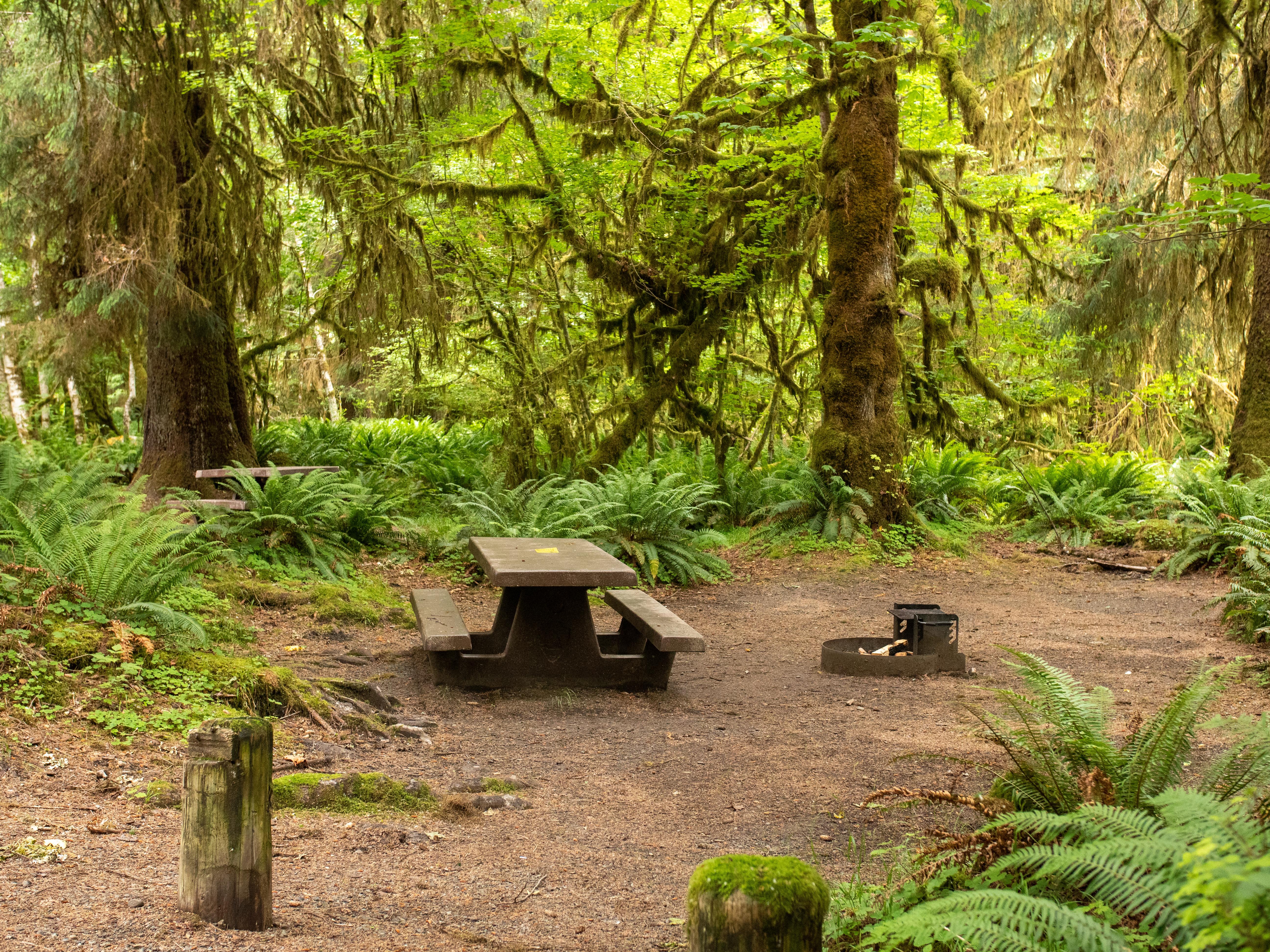
Hoh Rain Forest Campground
Olympic National Park's signature rainforest campground sits at 578 feet along the Hoh River, deep in one of the wettest places in the contiguous United States — over 140 inches of rain a year drape the bigleaf maples and Sitka spruce in curtains of club moss. Eighty-eight sites spread under the canopy; the Hall of Mosses Trail (0.8 mi) leaves from the campground entrance, and the Hoh River Trail runs 17.3 miles to Glacier Meadows on Mount Olympus. Reserve on Recreation.gov for peak summer; first-come, first-served in the shoulder seasons.
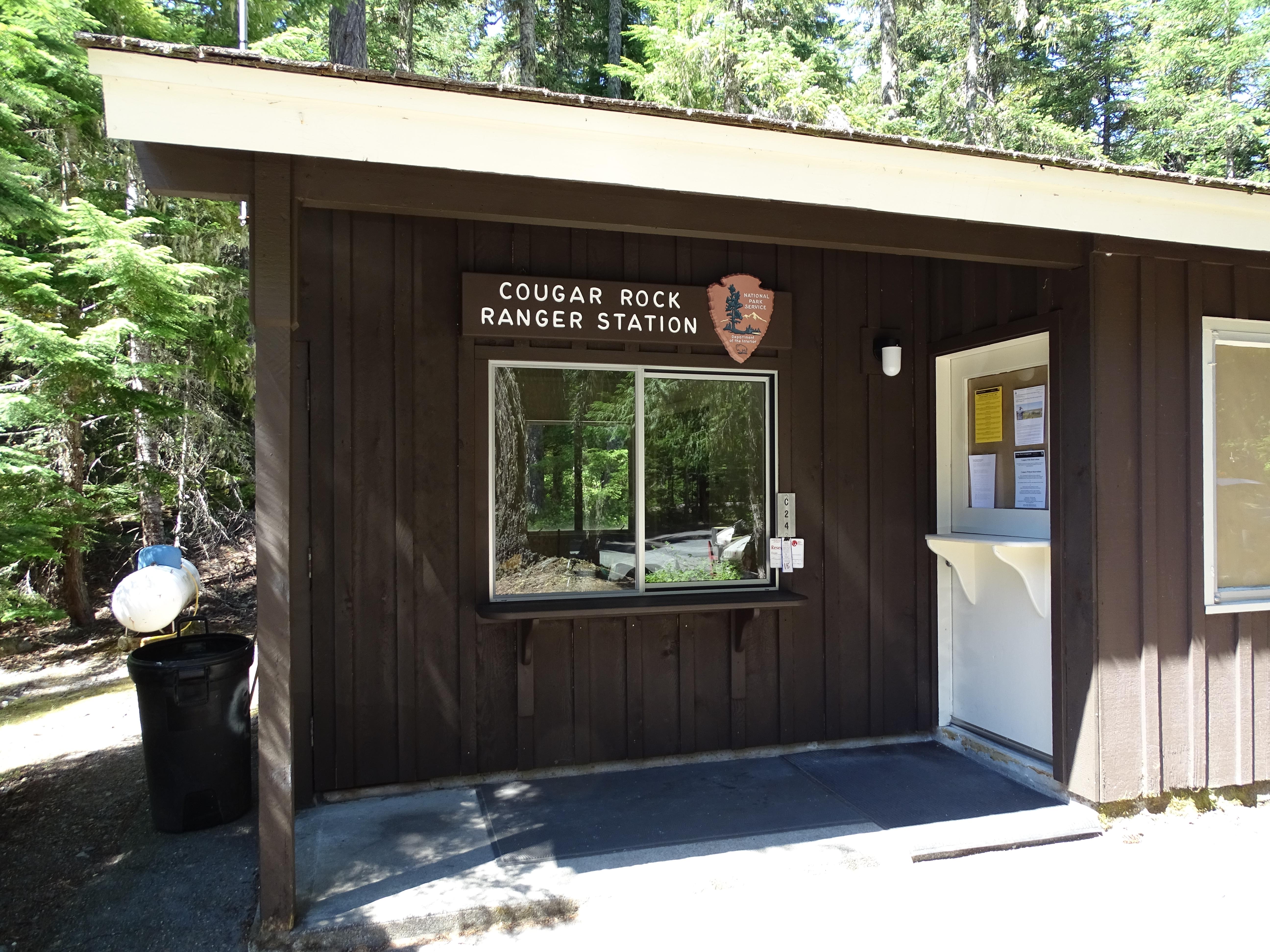
Cougar Rock Campground
Mount Rainier's south-side workhorse — 173 sites at 3,180 feet along the Nisqually River, six miles below Paradise, one of the snowiest spots in the Lower 48 (averaging 53 feet annually). Paved loops accommodate tents and medium RVs, no hookups, with a dump station and walking distance to historic Longmire. The drive up to Paradise meadows opens into a postcard of glaciers and wildflowers by late July. Reservations open six months ahead on Recreation.gov and summer weekends sell out within minutes.
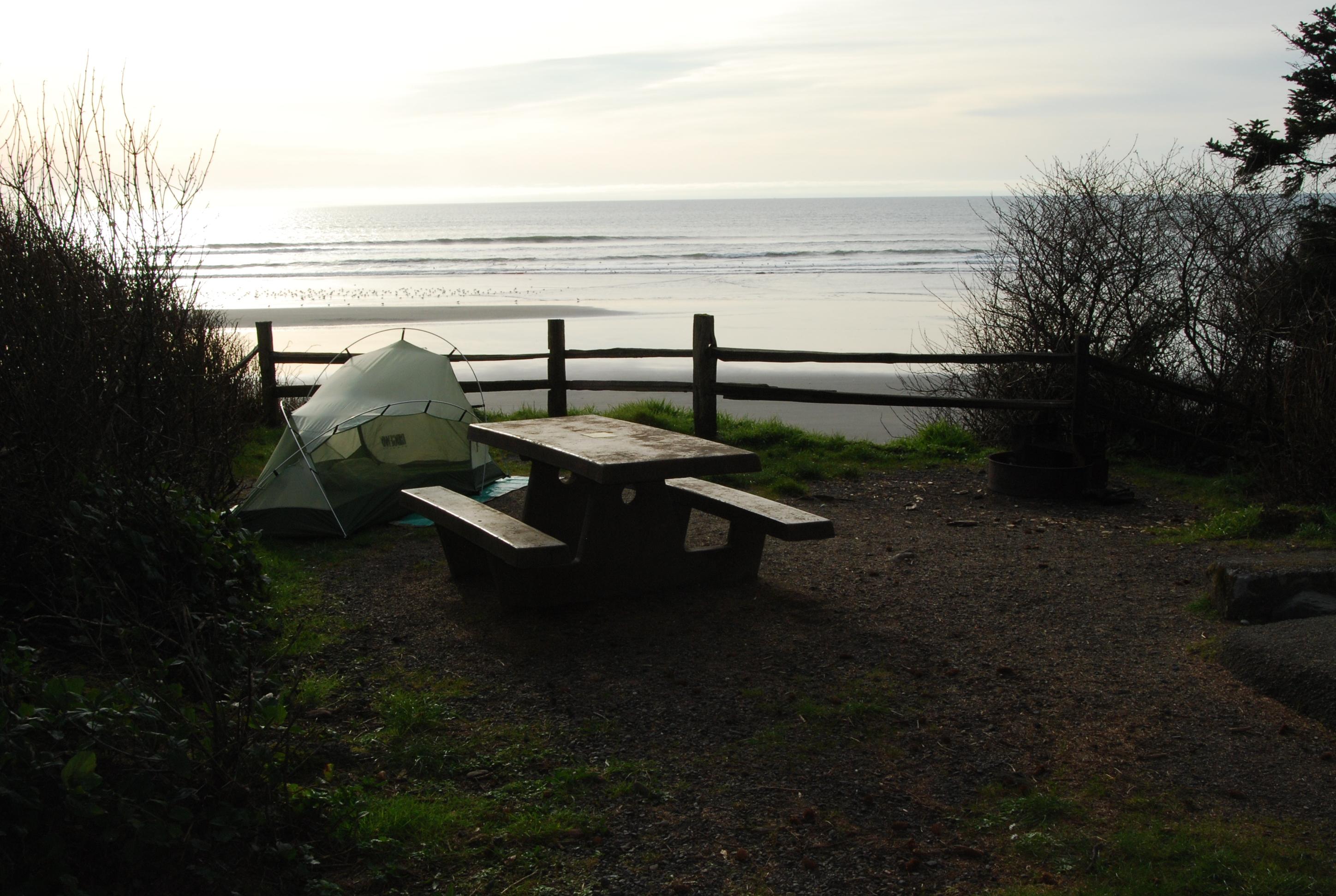
Kalaloch Campground
Perched on a 50-foot bluff between Ruby Beach and the mouth of the Hoh River, Kalaloch is Olympic's coastal classic — 168 sites with the Pacific roaring just beyond the salal hedges. The Tree of Life root cave, where a Sitka spruce somehow clings to nothing, is a quarter mile south. Driftwood, sea stacks, and tide pools are the daily routine. Reservable mid-June through Labor Day; first-come the rest of the year. Storm-watching season from November through February brings 20-foot Pacific swells.
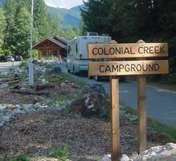
Colonial Creek South Campground
North Cascades National Park's headline campground sits on the south shore of Diablo Lake at 1,200 feet, where glacial silt turns the reservoir an electric turquoise visible from space. 96 sites line the lakeshore along the North Cascades Highway (SR-20). The Thunder Knob Trail (3.6 mi RT, 600 ft of gain) and Pyramid Lake Trail (4.4 mi RT) both leave from camp. Reservable mid-May through late September on Recreation.gov; SR-20 closes seasonally over Washington Pass.
- 05White River CampgroundMount Rainier's northeast gateway sits at 4,400 feet along the White River, with 112…→
- 06Iron Creek CampgroundGifford Pinchot National Forest's 98-site campground on the Cispus River is the closest Forest…→
- 07Douglas Fir CampgroundMount Baker-Snoqualmie National Forest's classic Mt. Baker Highway (SR-542) campground sits along the North…→
- 08Sol Duc Hot Springs CampgroundOlympic National Park's Sol Duc Valley loops run along the Sol Duc River through…→
- 09Spring Canyon CampgroundLake Roosevelt National Recreation Area's Spring Canyon sits at 1,300 feet immediately adjacent to…→
- 10Salmon La Sac CampgroundWenatchee National Forest's east-side gateway to the Alpine Lakes Wilderness — 67 sites at…→
§ 03 — Field Data
The working page
Best Time
Cascade high country opens. Paradise at Mount Rainier is typically free of snow by late June; the North Cascades Highway opens late April through May depending on the year; Sunrise opens by early July. The San Juan Islands peak now. The Olympic coast stays in the 60s and never gets hot — Kalaloch and Mora are summer-perfect. East WA pushes into the 90s and beyond. Wildfire smoke is the seasonal risk from mid-July through early October, especially east of the crest and in the North Cascades. Rainier's Cougar Rock, White River, and Ohanapecosh reservation pressure binds tightly — six-month windows fill within minutes for summer weekends.
Reservations
Permits & Signal
Camping Etiquette
USFS, state-park, and BLM campgrounds welcome leashed dogs throughout most loops and trails. National parks restrict pets to campgrounds, paved roads, and a small number of paved trails — never on dirt trails, never in the…
§ 04 — Almanac
Four seasons, four readings
Spring
Mar–May
Wet and gray west of the Cascades. The Hoh and Quinault rainforests are at full saturation — 140-plus inches a year drape the canopy in dripping moss — and the Olympic coast is shoulder-ready, cool but accessible. Cascade high country stays snowbound: Hurricane Ridge Road and Paradise Road stay snowbound into late May or June; the North Cascades Highway (SR-20) typically reopens late April through May. Olympic NP's Hoh Visitor Center and Kalaloch Campground stay open year-round. East of the crest, eastern Washington hits the 70s by April — Steamboat Rock, the Grand Coulee, and Lake Roosevelt are at their best while the west side is still draining out.
Summer
Jun–Aug
Cascade high country opens. Paradise at Mount Rainier is typically free of snow by late June; the North Cascades Highway opens late April through May depending on the year; Sunrise opens by early July. The San Juan Islands peak now. The Olympic coast stays in the 60s and never gets hot — Kalaloch and Mora are summer-perfect. East WA pushes into the 90s and beyond. Wildfire smoke is the seasonal risk from mid-July through early October, especially east of the crest and in the North Cascades. Rainier's Cougar Rock, White River, and Ohanapecosh reservation pressure binds tightly — six-month windows fill within minutes for summer weekends.
Fall
Sep–Nov
The highest wildfire window runs late September through October before the rains return. The North Cascades Highway (SR-20) gates by mid-October to mid-November depending on snow, with Chinook Pass (SR-410) and Cayuse Pass (SR-123) at Rainier closing in the same window. Larch needles turn gold in the eastern North Cascades — the third week of September through mid-October — and the Maple Pass Loop is the most-hiked larch trail in the state. The Olympic coast is at its clearest in September and early October before the storm season fires up. Cougar Rock and White River close by late September; the lower-elevation rainforest campgrounds (Hoh, Sol Duc, Kalaloch) run through October.
Winter
Dec–Feb
Wet on the west side, snow-locked above roughly 3,000 feet in the Olympics and 4,000 feet in the Cascades. Paradise stays open year-round for snowshoe and ski access — the road is plowed Monday through Sunday, weather permitting, with gate closures for active storms. Hurricane Ridge is open weekends only (Friday–Sunday, snow-dependent). The North Cascades Highway is gated, typically mid-November through April. The Olympic coast stays accessible: storm-watching season at Kalaloch brings 20-plus-foot Pacific swells from November through February, and the bluff campground stays open through it.
§ 05A — Activity File
Best for Hiking & Backpacking
Washington's hiking is built on the volcanic Cascade crest — Rainier at 14,411 feet, Baker, Adams, Glacier Peak — the Olympic Peninsula's Hoh and Quinault rainforest valleys, the North Cascades' alpine objectives in the so-called American Alps, and the Olympic Wilderness Coast for a multi-day shoreline traverse. These four campgrounds anchor the best of it.
Cougar Rock Campground
Six miles below Paradise — the Skyline Trail (5.5 mi loop) and Pinnacle Peak Saddle leave from the visitor center, and the Wonderland Trail crosses the Nisqually at Longmire five miles south of camp.
Colonial Creek South Campground
Thunder Knob (3.6 mi RT) and Pyramid Lake (4.4 mi RT) start at camp, and the Diablo Lake Trail crosses the suspension bridge to the powerhouse and Sourdough Mountain trailhead.
White River Campground
Sunrise sits six miles up the road — Mt. Fremont Lookout (5.6 mi RT), Burroughs Mountain (5–9 mi RT through three tiers of subalpine ridge), and the Sourdough Ridge nature loop all leave from there.
Hoh Rain Forest Campground
The Hall of Mosses (0.8 mi RT) leaves from the visitor center, and the Hoh River Trail runs 17.3 miles to Glacier Meadows below the Blue Glacier on Mount Olympus — Washington's premier rainforest-to-glacier backpack.
§ 05B — Activity File
Best for RV Camping
Washington's RV camping is mostly federal — paved NPS loops at Rainier and Olympic, a year-round bluff campground on the Pacific coast, and east-WA hookup loops on the Columbia. None of these have full hookups inside Rainier or Olympic, but dump stations and well-graded sites accommodate rigs up to roughly 35 feet. The standouts:
Cougar Rock Campground
173 sites at 3,180 feet on paved loops inside Rainier NP — no hookups, but a dump station, potable water, and drive-in sites accommodating rigs up to 35 feet make this the south-side RV pick.
Kalaloch Campground
168 bluff-edge sites open year-round on the Olympic coast — a rare combination on the Pacific. No hookups, dump station on site, and storm-watching season from November through February draws RV travelers in the off-season.
Spring Canyon Campground
East WA's year-round RV pick at 1,300 feet on Lake Roosevelt — hookup loops, a swim beach on the Columbia reservoir, and dry sage-pine steppe climate that stays usable when Cascade campgrounds are closed for the season.
Sol Duc Hot Springs Campground
Roughly 82 sites in the Sol Duc Valley with the concessioner-run hot mineral pools next door (separate entry fee). Reservable on Recreation.gov late March through October; no hookups in the NPS loops.
§ 05C — Activity File
Best for Temperate Rainforest & Hot Springs
The Olympic Peninsula is the only place in the Lower 48 with temperate rainforest at scale — 140-plus inches of rain annually at the Hoh, a Sitka spruce / western hemlock / Douglas fir / bigleaf maple canopy hung with epiphytic mosses and licorice ferns. Sol Duc adds the rare rainforest-meets-thermal-pools pairing. Three campgrounds cover it.
Hoh Rain Forest Campground
Ground zero for Lower-48 rainforest — 140-plus inches of rain a year, the densest canopy in the contiguous states, with club moss draping bigleaf maple branches in cathedral-thick curtains overhead.
Sol Duc Hot Springs Campground
Old-growth hemlock and cedar along the Sol Duc River, three concessioner-run mineral pools next door, and Sol Duc Falls 0.8 miles off the road — the rainforest-and-soak combination is unique on the peninsula.
Kalaloch Campground
Coastal-rainforest transition zone where Sitka spruce meets the Pacific — salal undergrowth, driftwood logs the size of locomotives, and tide-pool reefs at low tide along the bluff-foot beach.
§ 05D — Activity File
Best for Cascade Volcanoes & Glaciers
Washington holds five active volcanoes — Rainier, Baker, Adams, Glacier Peak, and St. Helens — and the North Cascades carry more than 300 glaciers, the most active glaciation of any state outside Alaska. These four campgrounds anchor Rainier's south and Sunrise sides, the North Cascades, and Mount St. Helens' east-side blast zone.
Cougar Rock Campground
Mount Rainier's south side — the Nisqually Glacier terminates visibly above Glacier Vista, and 25 named glaciers spread across the peak make Rainier the most heavily glaciated mountain in the Lower 48.
White River Campground
4,400 feet on Rainier's northeast side — Sunrise (6,400 ft, the park's highest vehicle access) sits six miles up the road, with an Emmons Glacier viewpoint looking straight across the largest glacier in the contiguous United States.
Colonial Creek South Campground
The American Alps — the North Cascades' 300-plus glaciers grind rock to flour that turns Diablo Lake's water the unmistakable turquoise you see from camp, and SR-20 climbs into the heart of it.
Iron Creek Campground
The Forest Service base for east-side Mount St. Helens — FR-99 climbs 20 miles up to Windy Ridge, into the 1980 pyroclastic flow zone, looking directly across Spirit Lake into the crater.
§ 07 — Q & A
Frequently asked
It depends on the region. Cascade high country (Paradise at Rainier, Sunrise, the North Cascades, Artist Point) is mid-June through September, with snow lingering on shoulder weeks. Olympic rainforest (Hoh, Sol Duc, Quinault) runs year-round, driest July through September. The Olympic coast is year-round, calmest July through October, with storm-watching season November through February. San Juan Islands peak July through August, with quieter shoulders in May–June and September. East Washington (Lake Roosevelt, the Channeled Scablands, Wenatchee NF) runs May through October with peak July through September and a mild winter window for the lowest-elevation parks.
§ 08 — Adjacent Sheets