FIELD GUIDE · CHAPTER 31 · REGION IIEST. 2026
New Mexico
Land of Enchantment
NM · 34°24′ N · 106°07′ W · 437 SITES SURVEYED
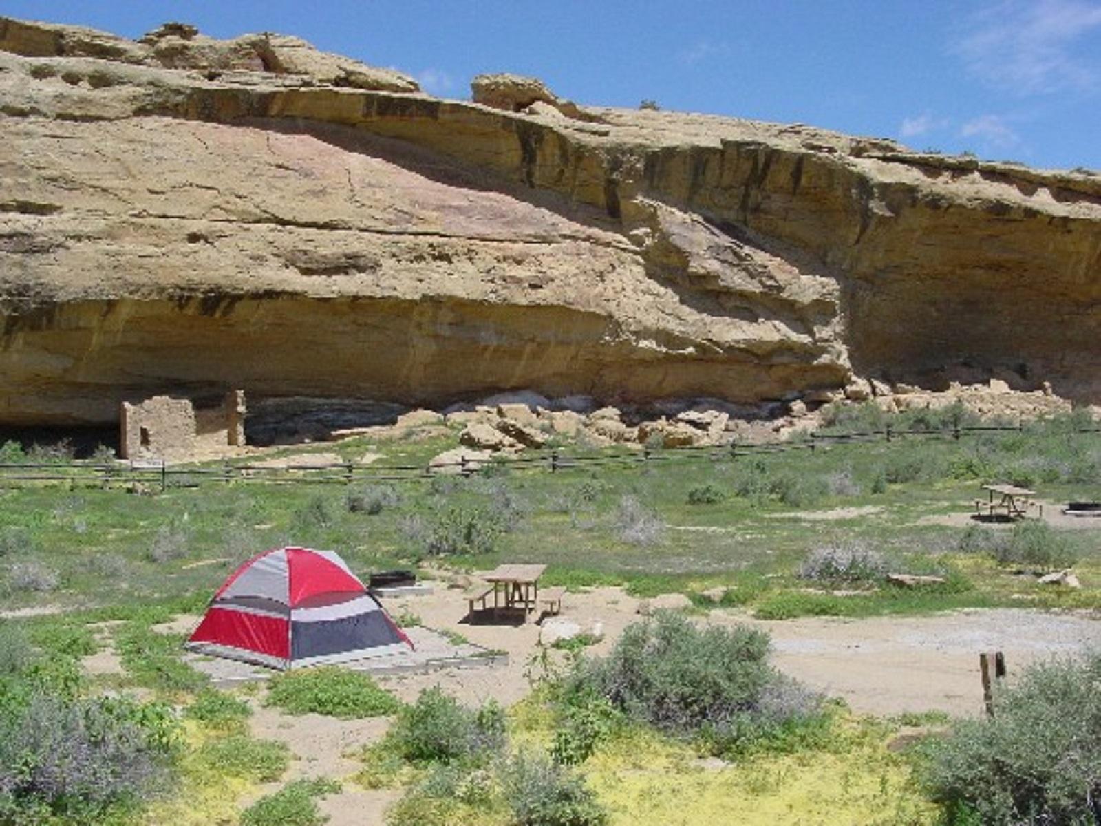
GALLO CAMPGROUND — CHACO CULTURE NHP · PLATE A-311
§ 01 — Opening Plate
A letter from the field
New Mexico's camping identity is the densest concentration of ancestral Pueblo and rock-art sites in the United States, stacked across more than 9,000 feet of vertical relief between the White Sands gypsum dunes at 4,000 feet and Wheeler Peak at 13,167. Chaco Culture is both a UNESCO World Heritage Site and an International Dark Sky Park. Bandelier's Frijoles Canyon cavates sit ten miles from Los Alamos. The Gila Wilderness was the first designated wilderness on Earth in 1924. Carlsbad's caverns dissolved out of a 250-million-year-old fossil reef. The Sangre de Cristos form the southernmost Rockies, and the Sacramento Mountains rise as a forested sky island above the Tularosa Basin. The state holds the highest mean elevation outside the Mountain West core, sees the North American monsoon as its dominant summer hazard from early July through mid-September, and protects more dark-sky designated places per capita than nearly any other state.
§ 02 — The Plates
Top 10 sites, filed
Gallo Campground — Chaco Culture NHP
The flagship and the spine of any New Mexico trip. Forty-nine sites under cottonwoods at 6,200 feet, no hookups, potable water at the visitor center only. Reservations on Recreation.gov open six months ahead. Chaco is an International Dark Sky Park — Casa Rinconada and Pueblo Bonito sit within walking distance via the nine-mile loop drive, and the Milky Way is the show after dusk. Access is sixteen miles of washboard NM-7950 from US-550; the road turns impassable for RVs after rain.
Juniper Family Campground — Bandelier NM
On the Pajarito Plateau at 6,600 feet, open year-round with fifty-plus sites tucked under piñon and ponderosa. The trailhead into Frijoles Canyon is one mile away; the cliff-dwelling cavates, the Long House wall, and the Alcove House ladder route all fall within a three-mile round trip. Reservations on Recreation.gov. From Memorial Day through mid-October day visitors must ride the Bandelier shuttle from White Rock, but registered campers may drive directly to the canyon floor.
Aguirre Spring Recreation Area — Organ Mountains
BLM Organ Mountains-Desert Peaks National Monument, 5,500 feet on the east face of the Organs, looking straight across the Tularosa Basin to White Sands NP. Fifty-five first-come, first-served sites — no reservations. Pine Tree National Recreation Trail (4.2-mile loop) and Baylor Pass (6.2-mile traverse) start at camp. The access road off US-70 is narrow and switch-backed with a strict 22-foot RV maximum. Alpenglow firing the Needles spires at sunset is the campground's signature.
Iron Creek Campground — Gila NF
Strung along NM-152, the Geronimo Trail Scenic Byway, above Silver City at about 7,000 feet. Fifteen small sites under spruce-fir on the edge of the Gila Wilderness and the Black Range. Reservable on Recreation.gov from mid-April through October; several sites stay walk-up. The Continental Divide Trail and a tangle of Black Range loops drop in from the campground itself. Vault toilets and no potable water — pack everything you'll drink in.
- 05Black Canyon Campground — Santa Fe NFOn NM-475, Hyde Park Road, at 8,400 feet above Santa Fe. Thirty-six sites scattered…→
- 06Wild Rivers Recreation Area — Río Grande del Norte NMBLM-managed unit on the rim of the Río Grande gorge near Questa at 7,300…→
- 07Cimarron Campground — Valle Vidal, Carson NFCarson NF high-country unit north of Cimarron and Eagle Nest at roughly 9,400 feet…→
- 08Sleepy Grass — Lincoln NF, CloudcroftSitting at 8,800 feet in the Sacramento Mountains above Cloudcroft. About forty-five sites tucked…→
- 09Valley of Fires Recreation Area — Carrizozo MalpaisBLM campground perched on the Carrizozo Malpais — a 5,000-year-old basalt lava flow 44…→
- 10Echo Amphitheater — Carson NF, AbiquiuCarson NF small campground (about ten sites) at the foot of the red sandstone…→
§ 03 — Field Data
The working page
Best Time
High country opens — Wild Rivers' Cebolla Mesa sub-units, Black Canyon, Sleepy Grass, Iron Creek, and Cimarron in Valle Vidal become the relief valve. The North American monsoon arrives early-to-mid July and runs through mid-September: daily afternoon thunderstorms, flash floods in arroyos and the Río Grande gorge tributaries, lightning above 8,000 feet. White Sands and Carlsbad daytime highs routinely top 100°F — pre-dawn or post-sunset visits only. The Tularosa Basin around Valley of Fires tops 100°F most July afternoons and can push past 105°F. Gila Wilderness backpacking peaks despite the monsoon, but early starts and ridge avoidance are non-negotiable once cells start building by 1 PM.
Reservations
Permits & Signal
Camping Etiquette
Yes on most USFS lands — Carson, Santa Fe, Cibola, Lincoln, and Gila national forests all allow dispersed camping for up to 14 days within any 30-day window, though specific rules vary by district. BLM lands…
§ 04 — Almanac
Four seasons, four readings
Spring
Mar–May
Desert south hits peak comfort — White Sands gypsum is most walkable now and Carlsbad daytime stays cooler than the brutal summer. North central thaws by April: Bandelier's Frijoles Canyon opens up and Santa Fe shoulders into shoulder season. The high country in the Sangre de Cristos, Wild Rivers, and Cimarron/Valle Vidal still carries snow at elevation through May. The defining hazard is wind — 40–60 mph gusts are normal across the eastern plains and Tularosa Basin in April, blowing tents flat and grounding small aircraft. Cottonwoods leaf along the Río Grande bosque mid-April. Chaco's washboard NM-7950 road is usually solid again by April after winter mud.
Summer
Jun–Aug
High country opens — Wild Rivers' Cebolla Mesa sub-units, Black Canyon, Sleepy Grass, Iron Creek, and Cimarron in Valle Vidal become the relief valve. The North American monsoon arrives early-to-mid July and runs through mid-September: daily afternoon thunderstorms, flash floods in arroyos and the Río Grande gorge tributaries, lightning above 8,000 feet. White Sands and Carlsbad daytime highs routinely top 100°F — pre-dawn or post-sunset visits only. The Tularosa Basin around Valley of Fires tops 100°F most July afternoons and can push past 105°F. Gila Wilderness backpacking peaks despite the monsoon, but early starts and ridge avoidance are non-negotiable once cells start building by 1 PM.
Fall
Sep–Nov
The broadest sweet spot. Aspens peak in the Sangre de Cristos the last week of September through mid-October — Wheeler Peak Wilderness, Hyde Park, and the Santa Fe Ski Basin road run gold against dark spruce. Cottonwoods turn along the Río Grande bosque mid-October. Monsoon humidity fades by mid-September and dark-sky viewing peaks because the air dries out — Chaco, Wild Rivers, and Valley of Fires hit their best clarity of the year. Chaco's optimum visit window lands here: daytime cool, washboard NM-7950 still drivable. Northern high country closes to first snow by early November and gates start shutting on the forest roads.
Winter
Dec–Feb
The desert flips to peak. Carlsbad, White Sands, Valley of Fires, and Aguirre Spring all run their calmest, coolest stretch — 60s by day, 30s overnight. Cloudcroft and the Sangre de Cristos pile cross-country skiing snow in the Sacramentos. Bandelier's Juniper Family Campground stays open year-round at 6,600 feet with occasional snow on the Pajarito Plateau. Chaco's NM-7950 access is generally passable but worse in winter mud — always call ahead before committing the drive. The southern BLM/RIDB sites stay mild: Aguirre Spring at 5,500 feet and Valley of Fires at 4,500 feet rarely see hard freezes.
§ 05A — Activity File
Best for Hiking & Backpacking
New Mexico stacks Pueblo-era cavate ladders against alpine wilderness loops in a way no other state does. Bandelier's Frijoles Canyon cliff dwellings, the Gila Wilderness (the first designated wilderness on Earth, 1924), the Río Grande gorge descent to a sandbar between black basalt walls, and the Organ Mountains' Pine Tree loop above the Tularosa Basin all land within a long weekend's drive.
Juniper Family Campground — Bandelier NM
The Frijoles Canyon trailhead is one mile from camp — cavate routes along the Long House wall, the Alcove House ladder, and the cliff-base loop all fall inside a three-mile round trip from the canyon floor.
Iron Creek Campground — Gila NF
Sitting on the edge of the Gila Wilderness — the first designated wilderness on Earth (1924) — with the Continental Divide Trail and a tangle of Black Range loops dropping straight off NM-152 at the campground itself.
Aguirre Spring Recreation Area — Organ Mountains
The 4.2-mile Pine Tree National Recreation Trail loop and the 6.2-mile Baylor Pass traverse start at camp under the Needles spires — the Southwest's most under-rated four-mile hike with alpenglow at sunset.
Wild Rivers Recreation Area — Río Grande del Norte NM
A 1.6-mile descent off the rim drops to La Junta Point where the Red River meets the Río Grande between black basalt walls — one of the most dramatic short hikes in the southern Rockies.
§ 05B — Activity File
Best for RV Camping
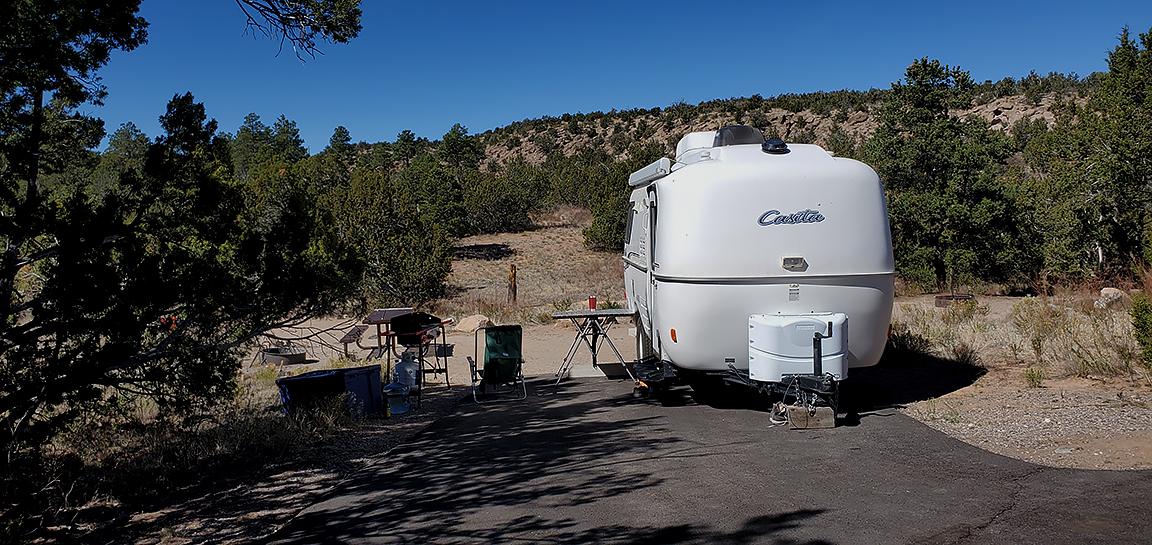
New Mexico's top-tier campgrounds skew dry. Of the top ten, only Valley of Fires has electric hookups — the rest accommodate RVs but expect to dry-camp. The elevation range from 4,500 feet (Valley of Fires) to 8,800 feet (Sleepy Grass) gives natural temperature relief in summer, and several access roads narrow or wash out, so check rig length before committing.
Valley of Fires Recreation Area — Carrizozo Malpais
The only campground in the New Mexico top ten with electric hookups — nineteen sites, year-round, fully reservable on Recreation.gov at 4,500 feet on the rim of the Carrizozo Malpais lava flow.
Sleepy Grass — Lincoln NF, Cloudcroft
Hardstand sites under Douglas fir at 8,800 feet in the Sacramento Mountains. No hookups, but pull-throughs accommodate larger rigs and the elevation drops July overnights into the 40s — natural summer relief from the Tularosa Basin.
Cimarron Campground — Valle Vidal, Carson NF
Carson NF high-country sites at 9,400 feet on the south edge of Valle Vidal. No hookups and the access road is FR-1950 gravel off US-64 — fine for trailers and Class C's, but tight for big fifth wheels.
Gallo Campground — Chaco Culture NHP
Type B sites accommodate RVs to roughly thirty feet with no hookups. The hard part is the sixteen miles of washboard NM-7950 off US-550 — impassable for larger rigs after rain, so check the forecast before committing.
§ 05C — Activity File
Best for Stargazing & Dark-Sky Sites
Three of New Mexico's federally designated dark-sky sites sit inside top-10 campgrounds in this guide. Chaco Culture NHP and Capulin Volcano are International Dark Sky Parks; Salinas Pueblo Missions and Clayton Lake SP are certified; and the Cosmic Campground in the Gila NF became the world's first International Dark Sky Sanctuary in 2016. The Milky Way reads as a structured arc, not a smudge.
Gallo Campground — Chaco Culture NHP
Chaco is an International Dark Sky Park, and Casa Rinconada and Pueblo Bonito were laid out on celestial alignments a thousand years ago — summer-solstice sight lines through the great-house doorways still hold.
Valley of Fires Recreation Area — Carrizozo Malpais
Set on the Carrizozo Malpais with no town glow on any horizon — the lava-field foreground gives an unbroken flat sweep to Polaris, and Carrizozo itself is one of the darkest small towns in the lower 48.
Wild Rivers Recreation Area — Río Grande del Norte NM
On the rim of Río Grande del Norte with zero light pollution within thirty miles — Questa is the only town in any direction, and the gorge cuts a horizon as dark as anywhere in the southern Rockies.
Black Canyon Campground — Santa Fe NF
At 8,400 feet on Hyde Park Road in the Sangre de Cristos, the high country sits above Santa Fe's light dome — point a camera north up the ridge and the Milky Way pours out of the Sangres unobstructed.
§ 05D — Activity File
Best for Ancestral Sites & Rock Art
New Mexico holds a continuous human geography from Pueblo I through Pueblo IV (roughly AD 700–1600) — great-house masonry at Chaco, cavates at Bandelier, the Río Grande del Norte sacred corridor for Taos Pueblo, and the Tewa cultural geography around Abiquiu. These aren't isolated ruins; they're one connected story across a thousand vertical feet and seven hundred years.
Gallo Campground — Chaco Culture NHP
A UNESCO World Heritage Site — Pueblo Bonito, Chetro Ketl, and Casa Rinconada line the nine-mile loop drive with great-house masonry and summer-solstice site lines preserved at the scale Ancestral Puebloans built them.
Juniper Family Campground — Bandelier NM
Bandelier is the densest Pueblo II–IV concentration on the Pajarito Plateau, ten miles from Los Alamos — cavates hand-cut into volcanic tuff, the Long House wall, and the Alcove House kiva reached by ladder.
Wild Rivers Recreation Area — Río Grande del Norte NM
The Río Grande gorge sits in the northern Tewa ancestral corridor and is sacred to Taos Pueblo — visit with that context in mind, tread lightly on the rim, and don't disturb anything that looks like it belongs.
Echo Amphitheater — Carson NF, Abiquiu
Anchors the Abiquiu and Ghost Ranch corridor in the heart of Tewa cultural geography — Poshuouinge, the ancestral Tewa pueblo site, sits a few miles south on US-84 with an interpretive trail open to visitors.
§ 07 — Q & A
Frequently asked
It depends on elevation. Carlsbad Caverns and White Sands are October through April — summer in the Tularosa Basin clears 100°F by midday and the gypsum gets unwalkable. Chaco Culture is best April through June and again in October; the dirt access road and the dark-sky viewing both peak in those windows. Bandelier and Santa Fe (Black Canyon on Hyde Park Road) run comfortably April through November. The Gila Wilderness is April through November with monsoon caution from mid-July to mid-September. The Sangre de Cristos high country — Wild Rivers, Black Canyon, Cimarron in Valle Vidal — opens June through September after snow clears. The Sacramentos around Cloudcroft (Sleepy Grass, Apache) cover May through October for camping and December through March for cross-country skiing on the season's snowpack.
§ 08 — Adjacent Sheets