FIELD GUIDE · CHAPTER 02 · REGION IEST. 2026
Alaska
The Last Frontier
AK · 64°04′ N · 152°17′ W · 378 SITES SURVEYED
RILEY CREEK — DENALI NATIONAL PARK · PLATE A-021
§ 01 — Opening Plate
A letter from the field
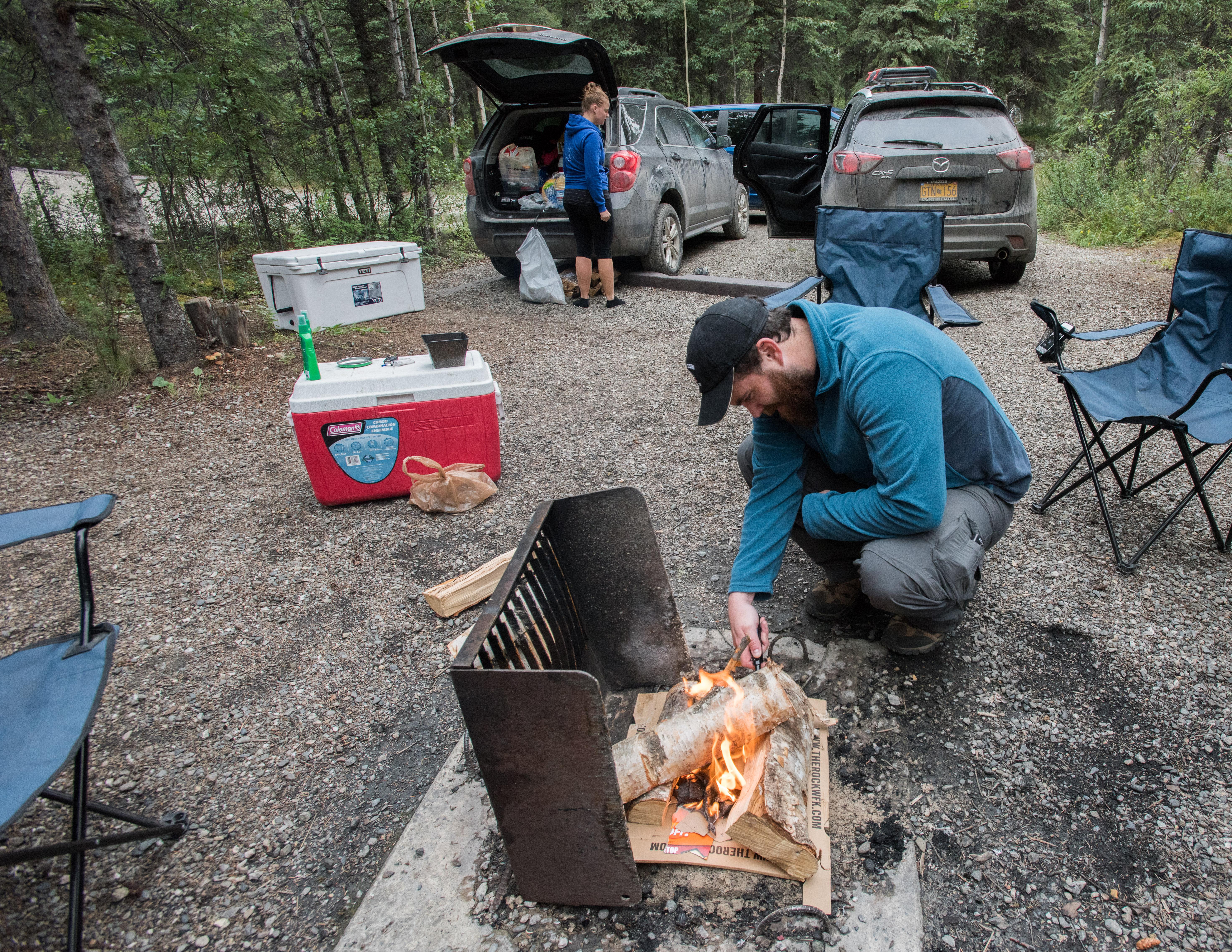
Alaska holds the largest national parks in the United States, and almost none of them touch a road. Its road network is tiny for its size — vast stretches are fly-in or boat-in only — which makes the handful of road-accessible landscapes precious. The Parks Highway threads Denali; the Seward and Sterling highways open the Kenai Peninsula and Chugach National Forest; the gravel Nabesna Road reaches into Wrangell–St. Elias, the largest national park in the country; the Alaska Marine Highway ferries you to Mendenhall Glacier outside Juneau; and the Denali and Dalton highways run the wild Interior toward the Arctic. What you camp beside here is unlike anywhere else: glaciers calving across a lake, sockeye runs thick enough to draw brown bears within sight of your tent, and twenty-plus hours of summer daylight that erases any sense of bedtime.
§ 02 — The Plates
Top 10 sites, filed
Riley Creek — Denali National Park
The flagship and the natural first night of any Denali trip. Around 140 sites near the park entrance off the Parks Highway at mile 237 — the largest campground in the park, with some pull-throughs for RVs. Open year-round on a limited winter basis, reservable on Recreation.gov. The visitor center and the park's working sled-dog kennels sit a short walk away, and Riley Creek runs cold and clear past the spruce-shaded loops. A practical, well-served basecamp before you head deeper in.
Teklanika River — Denali National Park
Mile 29 on the Denali Park Road — the deepest point private vehicles may drive, and only with the three-night-minimum reservation locals call the Tek pass. Roughly 53 sites sit in spruce above the braided gray channels of the Teklanika River. You park for the duration; to go deeper you board the park transit buses right at camp. The trade is real solitude past the entrance crowds and a serious chance of grizzlies, caribou, and Dall sheep on the slopes above. Book early — the Tek sites go fast.
Exit Glacier Campground — Kenai Fjords NP
The only road-accessible corner of Kenai Fjords National Park, reached on the spur road out of Seward. About a dozen walk-in tent sites, free and first-come — no RVs, no reservations. The Harding Icefield Trail climbs from here, 8.2 miles round trip and roughly 3,500 feet of gain to a vast ice sheet; a gentler loop marks Exit Glacier's retreat on signposts. Black and brown bears work the valley, so hard-sided food lockers are mandatory. Bring rain gear — the air off the icefield stays cold in July.
Mendenhall Lake Campground — Tongass NF
A Tongass National Forest campground about 13 miles from downtown Juneau, with sites facing straight across Mendenhall Lake to the face of Mendenhall Glacier and the icebergs drifting off it — one of the few drive-up glacier views in Southeast Alaska. Reservable on Recreation.gov. The catch is getting here: Juneau connects to the rest of the world only by Alaska Marine Highway ferry or by air, so bring a vehicle on the ferry or rent in town. Rainforest understory and the steady crack of calving ice define the stay.
- 05Quartz Creek Campground — Chugach NFOn the Sterling Highway where it meets the turquoise water of Kenai Lake near…→
- 06Russian River — Chugach NF, Cooper LandingAt the confluence of the Russian and Kenai rivers in Cooper Landing, this Chugach…→
- 07Williwaw Campground — Chugach NF, PortageTucked into Portage Valley off the Seward Highway, Williwaw frames hanging glaciers — Explorer…→
- 08Kendesnii Campground — Wrangell–St. Elias NPThe only developed National Park Service campground inside Wrangell–St. Elias, the largest national park…→
- 09Tangle Lakes Campground — Denali HighwayA BLM campground on the mostly gravel Denali Highway near Paxson, perched around 2,900…→
- 10Marion Creek Campground — Dalton HighwayThe northernmost stop on this list, a BLM campground around mile 180 of the…→
§ 03 — Field Data
The working page
Best Time
The season Alaska is built for. Near-solstice daylight runs roughly 18 to 22 hours and bedtime turns optional. Salmon drive the calendar — Kenai and Russian River sockeye peak late June into July, drawing brown bears to the same banks as the anglers. Crowds and reservations peak with them, so book Recreation.gov sites like Riley Creek and Mendenhall well ahead, and expect real mosquitoes. In Denali, private vehicles can't drive deep into the park; you ride the transit and shuttle buses. Afternoon rain is frequent across Southcentral and Southeast — the Tongass is a rainforest. Warmest of the year, but pack rain gear.
Reservations
Popular Recreation.gov campgrounds — Riley Creek at Denali, Mendenhall near Juneau, Russian River on the Kenai — book months ahead for summer, so reserve early; some campgrounds still keep a share of first-come sites. In Denali,…
Permits & Signal
Camping Etiquette
Generally yes, on much of Alaska's federal and state land. Chugach and Tongass national forests, BLM lands, and many state lands permit dispersed or backcountry camping, usually with stay limits — often around 14 days —…
§ 04 — Almanac
Four seasons, four readings
Spring
Apr–May
Break-up — Alaska's mud season. Snow lingers at elevation and on the gravel routes, so the Nabesna, Denali Highway, and Dalton run soft and rough where they're open at all. The Denali Park Road opens only partway early, and high-country access stays gated. Lower elevations and the Kenai thaw first, which is where you point: low, southern, road-system sites like Quartz Creek and Exit Glacier near Seward. Daylight lengthens fast, days stacking on minutes, and the crowds haven't arrived. A genuine shoulder season — quiet and cheap, but commit to the thawed-out south.
Summer
Jun–Aug
The season Alaska is built for. Near-solstice daylight runs roughly 18 to 22 hours and bedtime turns optional. Salmon drive the calendar — Kenai and Russian River sockeye peak late June into July, drawing brown bears to the same banks as the anglers. Crowds and reservations peak with them, so book Recreation.gov sites like Riley Creek and Mendenhall well ahead, and expect real mosquitoes. In Denali, private vehicles can't drive deep into the park; you ride the transit and shuttle buses. Afternoon rain is frequent across Southcentral and Southeast — the Tongass is a rainforest. Warmest of the year, but pack rain gear.
Fall
Sep–Oct
Short and spectacular. Termination dust — the first snow — settles on the peaks while the tundra turns red and gold; Denali's colors come early, late August into early September. Bears feed hard on the late silver (coho) runs before the cold. Campgrounds begin closing for the season, and at elevation the first snow can turn conditions fast. The Denali Road Lottery in mid-September briefly lets a few private vehicles drive the park road that buses own all summer. As the nights darken again the aurora returns over the Interior. Beautiful and brief — go light, move fast, and watch the forecast.
Winter
Nov–Mar
Most road campgrounds are closed or snowed-in; this isn't a developed-campground season. Riley Creek at Denali stays open for limited free winter walk-in use with no services — about the only year-round option on this list. The trip pivots to aurora viewing, best from the Interior around Fairbanks, plus winter-specific Interior travel. Cold runs extreme — the Interior can drop to −20 to −40°F — and days near the solstice are very short, a few hours of low light. Plan around the aurora, heated lodges, and the handful of year-round sites rather than tent loops. Come prepared for serious cold.
§ 05A — Activity File
Best for Hiking & Backpacking
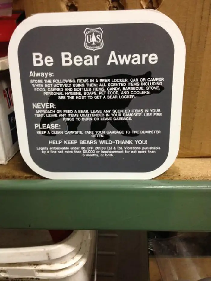
Alaska splits cleanly between two kinds of hiking. Denali offers almost no maintained trails — you walk off-trail across open tundra and gravel bars, route-finding for yourself. The Kenai and Chugach run the opposite way, with graded paths that climb glacier edges and lake shores. Every route here is bear country, so noise and food discipline come first.
Exit Glacier Campground — Kenai Fjords NP
The Harding Icefield Trail climbs straight from camp — 8.2 miles round trip and about 3,500 feet of gain to the edge of a vast ice sheet, with a gentler valley loop tracing the glacier's retreat below.
Teklanika River — Denali National Park
The deepest road-accessible base for off-trail tundra hiking in Denali. Ride the park transit bus farther west, step off anywhere, and route-find across open slopes and the braided gravel bars of the Teklanika.
Williwaw Campground — Chugach NF, Portage
A trail hub in Portage Valley — the Trail of Blue Ice runs to the visitor center, Byron Glacier Trail leads to lingering snow, and Portage Pass climbs to a view over the lake and glacier.
Russian River — Chugach NF, Cooper Landing
Trailheads for the Russian Lakes and Resurrection Pass routes open the Chugach high country from here, and the short Russian River Falls walk leads to a fish ladder where sockeye leap upstream in summer.
§ 05B — Activity File
Best for RV Camping
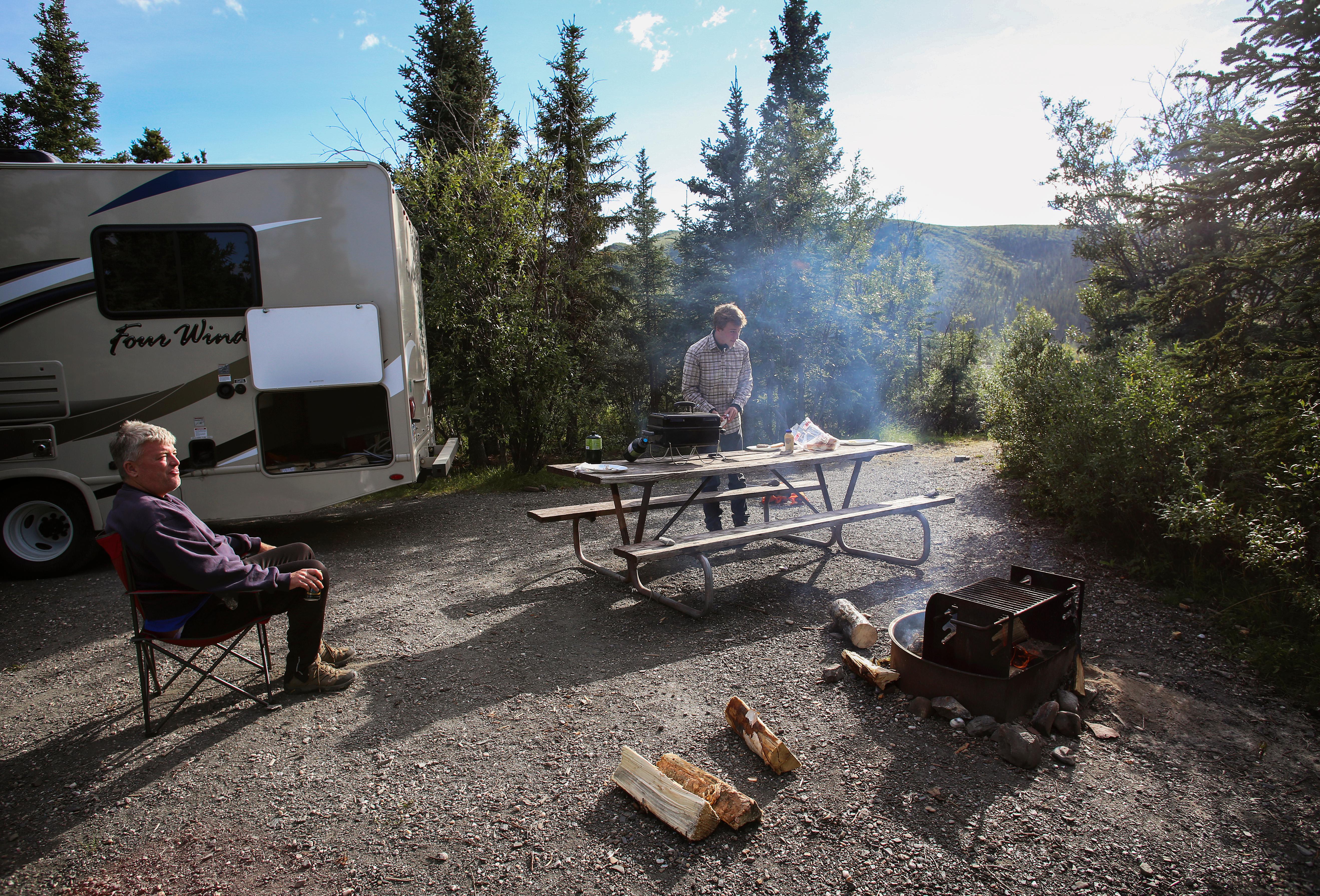
RV travel in Alaska is a road-system game. The Parks, Seward, and Sterling highways carry nearly all the drive-up camping, hookups are scarce, and dump stations sit far apart. The Alcan in and out is its own commitment. Gravel spurs like the Nabesna, Denali, and Dalton highways enforce real rig-length limits, so size your route to the road.
Riley Creek — Denali National Park
Denali's one big-rig campground — pull-throughs, paved access, and a dump station and water near the entrance Mercantile. It's effectively the end of the road for RVs: private vehicles can't drive deep into the park, so rigs stage here and ride the transit buses in.
Quartz Creek Campground — Chugach NF
Level gravel pads right off the paved Sterling Highway make the pull-in easy, but like most Chugach campgrounds it's dry — no hookups, so arrive with full water and a charged battery. Central enough to day-trip the whole upper Kenai.
Mendenhall Lake Campground — Tongass NF
A glacier-view base near Juneau, reachable only by Alaska Marine Highway ferry or air — bring the rig over on the ferry. Hookups are limited, but the sites face Mendenhall Glacier and reserve on Recreation.gov.
Williwaw Campground — Chugach NF, Portage
Paved access and roomy, level sites make Williwaw the easiest glacier-side stop for a big rig on the Seward Highway run. It's dry camping like the rest of Chugach, but the pull-ins are flat and forgiving — an effortless overnight between Anchorage and the Kenai.
§ 05C — Activity File
Best for Wildlife & Bear Viewing
Alaska's defining wildlife scenes are Denali's big five — grizzly, caribou, moose, Dall sheep, and wolf — spotted from the park road, and the brown bears that work the Kenai salmon runs alongside anglers. The skill that matters most here isn't spotting animals; it's keeping viewing distance and storing food correctly so bears stay wild and you stay safe.
Teklanika River — Denali National Park
The deepest road access in Denali puts grizzly, caribou, Dall sheep, and moose within view along the slopes above the braided Teklanika, with the park transit bus carrying you farther west for more.
Russian River — Chugach NF, Cooper Landing
When the sockeye run, brown bears work the same banks as the anglers. Electric fences and strict fish-waste rules keep the peace — treat the bears as residents and the river as their grocery aisle.
Williwaw Campground — Chugach NF, Portage
A salmon-viewing deck on Williwaw Creek lets you watch spawning fish from the boardwalk, and in fall the bears come down to the creek to feed on the run — close-up wildlife without leaving camp.
Exit Glacier Campground — Kenai Fjords NP
Mountain goats range the icefield slopes above camp, and both black and brown bears move through the valley below. Food lockers here are mandatory, not optional — keeping a clean camp is the price of sleeping in active bear country.
§ 05D — Activity File
Best for Glaciers & Icefields
Few places put you beside active ice as routinely as Alaska — tidewater and valley glaciers at Exit, Mendenhall, and Portage's hanging ice, and the immense icefields above Wrangell–St. Elias. The skill is reading the landscape: glacial outwash and meltwater channels shift fast, and unstable ice is no place to stand for a photo.
Exit Glacier Campground — Kenai Fjords NP
Camp near the toe of Exit Glacier with the Harding Icefield overlook climbing above. Signposts along the valley loop mark the ice's retreat by year — a visible record of how far the glacier has pulled back.
Mendenhall Lake Campground — Tongass NF
Sites look straight across the lake to Mendenhall Glacier as it sheds icebergs into the water. The short Nugget Falls trail leads to the glacier's flank and a waterfall pouring off the rock beside it — close-up ice from a drive-up campground.
Williwaw Campground — Chugach NF, Portage
Explorer and Middle glaciers hang on the valley walls directly above camp, and Portage Glacier and Byron Glacier sit a short drive or walk away — a dense cluster of ice within easy reach.
Kendesnii Campground — Wrangell–St. Elias NP
A quiet boreal base deep on the gravel Nabesna Road, this is the road-end jump-off for the Kennicott and Root glaciers and the vast icefields of the Wrangell and St. Elias ranges that feed them.
§ 07 — Q & A
Frequently asked
The core camping season is June through early September. June is built around near-solstice daylight — roughly 18 to 22 hours of light that erases any sense of bedtime — and the salmon runs peak from late June into July, the spectacle that draws brown bears to the same banks as the anglers. July and August are the warmest months but also the busiest and, in the Southeast, the wettest. May and September are quieter, cheaper shoulder weeks, but you trade comfort for cold, partial closures, and limited high-country access while the snow lingers and the gravel routes run soft. Winter, November through March, is not a developed-campground season at all; it pivots to aurora viewing and Interior travel rather than tent loops. For popular Recreation.gov sites, reserve months ahead — summer dates fill long before you arrive.
§ 08 — Adjacent Sheets