§ 02 — OVERVIEW
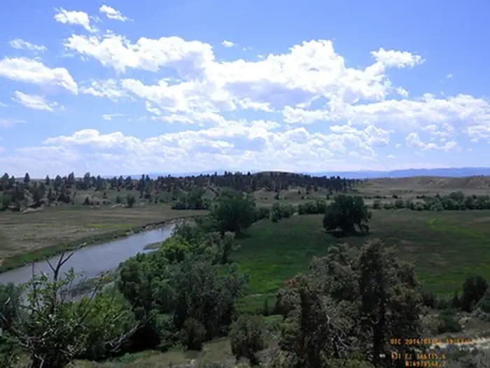
Mosier Gulch Picnic Area is managed by the Bureau of Land Management and the City of Buffalo and is adjacent to the Bighorn National Forest, managed by the USDA Forest Service. This ponderosa pine-forested area lies at the foothills of the Bighorn Mountains.
The recreation area encompasses almost 900 acres of ponderosa pine-forested lands ranging from 5,500 feet to 6,800 feet, and is a popular hiking area. A developed roadside picnic area complete with multiple parking areas, picnic tables, pedestal fire grates, and a vault toilet are available. In addition, the picnic area is along the Clear Creek Trail which leads back to the city of Buffalo to the east or into the Bighorn Mountains to the west. Other opportunities at Mosier Gulch include trout fishing along Clear Creek, hunting and wildlife viewing with opportunities to see mule deer, antelope, eagles, and occasionally black bear and elk. Mosier Gulch is a day use only facility. Camping, open fires, and target shooting are prohibited. There is a hand-pump well available during the summer months. Please help us keep the area clean and pack your trash out as garbage collection is not provided.
§ 03 — TRAILS NEARBY
§ 04 — CONDITIONS
National Weather Service · seven-day outlook · updated hourly
§ 05 — SIGNAL
FCC broadband data · actual signal varies in remote terrain
§ 06—09 — FROM THE FIELD
Community Intel from visitors, written reviews, dated trip reports, and reader-submitted photographs.
§ 07 — REVIEWS
Sign the ledger to file a review.
§ 08 — TRIP REPORTS
§ 09 — COMMUNITY PHOTOS
§ 01 — VITALS
Nearby Trails
Tue
82°F
Patchy Smoke
5 to 14 mph ESE
Wed
79°F
Showers And Thunderstorms
2 to 8 mph ESE
Thu
76°F
Showers And Thunderstorms
3 to 7 mph N
Fri
86°F
Sunny then Slight Chance Showers And Thunderstorms
8 mph W
Sat
89°F
Sunny then Slight Chance Showers And Thunderstorms
7 to 10 mph NW
Sun
86°F
Sunny then Slight Chance Showers And Thunderstorms
9 to 13 mph N
Mon
85°F
Mostly Sunny then Slight Chance Showers And Thunderstorms
7 to 10 mph N
Verizon
Based on FCC availability data. Actual signal may vary in remote terrain.
Trip Reports
0 reports
Sign in to add your own photos.
No community photos yet — be the first to share one from your visit.