 0.8 mi away
Belle Fourche River Campground
Campground · Wyoming
Wyoming
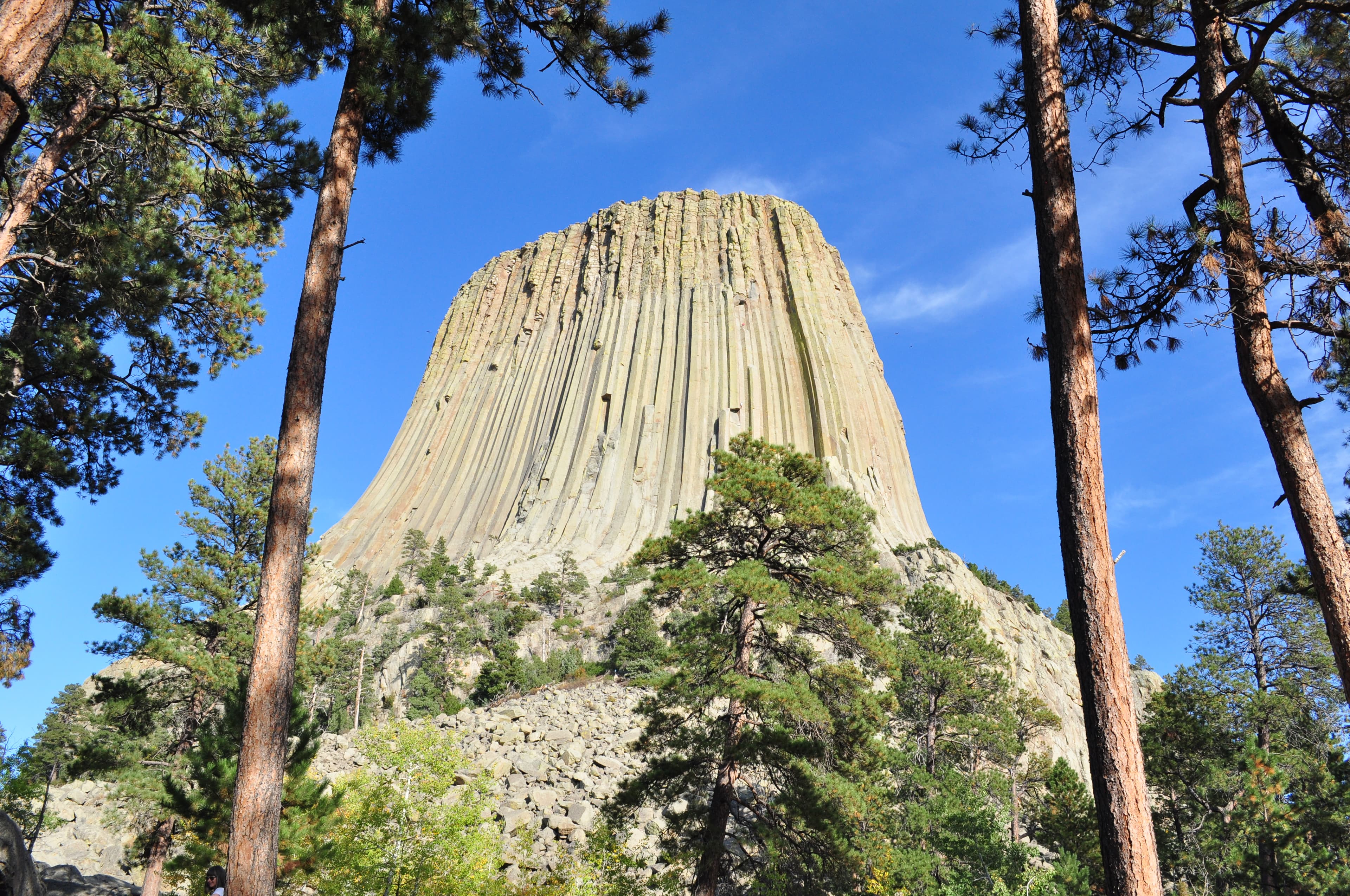
The Tower is an astounding geologic feature that protrudes out of the prairie surrounding the Black Hills. It is considered sacred by Northern Plains Indians and indigenous people. Hundreds of parallel cracks make it one of the finest crack climbing areas in North America. Devils Tower entices us to learn more, explore more and define our place in the natural and cultural world.
The park entrance is located 33 miles northeast of Moorcroft, 27 miles northwest of Sundance, and 52 miles southwest of Belle Fourche, SD. If approaching from the east or west, take US Hwy 14 to WY 24 (follow the signs from I-90). If approaching from the north, take WY 112 to WY 24 (from Montana) or SD 34 / WY 24 (from South Dakota).
Obtain forecast information before beginning your adventure at Devils Tower National Monument and observe changing weather conditions. Thunderstorms can develop quickly bringing lightning, hail, rain, slippery rock surfaces, and hypothermia. Summer days can bring very hot temperatures. Carry enough water, and realize the rock of the Tower can reach over 100 degrees Fahrenheit. Winter weather can bring blowing snow and road closures. Check local forecasts and road conditions before visiting.
0.0 mi away · 3.8 mi loop · 604 ft gain · Devils Tower National Monument
0.1 mi away · 4.0 mi out & back · 902 ft gain · Devils Tower National Monument
0.2 mi away · 3.9 mi loop · 727 ft gain · Devils Tower National Monument
0.5 mi away · 1.0 mi out & back · 228 ft gain · lwn
0.5 mi away · 1.5 mi loop · 225 ft gain · Devils Tower National Monument
Thu: Sunny · wind 5 mph S
Road, crowds, signal, and whether they'd go back — from people who camped here.
Been here? Tell the next visitor what the road, the crowds, and the signal were like.
No reviews yet. Been here? Yours would be the first.
Sign in to write a review.
From people who camped here.
Sign in to add photos from your visit.
The first one from your trip goes here.